Current Weather Conditions on 7th October 2013 @ 11.00 am.
Saurashtra has had some relief from rain past two days and similarly the quantum as well as coverage of rain in Gujarat has been less in Gujarat. However, this may not last very long. The Upper Air Cyclonic Circulation over North Madhya Pradesh was located over a broad area over Madhya Pradesh and Uttar pradesh border areas. This UAC ( it is a broad circulation ) would relocate to over Madhya Pradesh & adjoining Maharashtra areas by tomorrow. Subsequently it would track Westwards and is expected to be over West M.P. and adjoining North Maharashtra border areas.
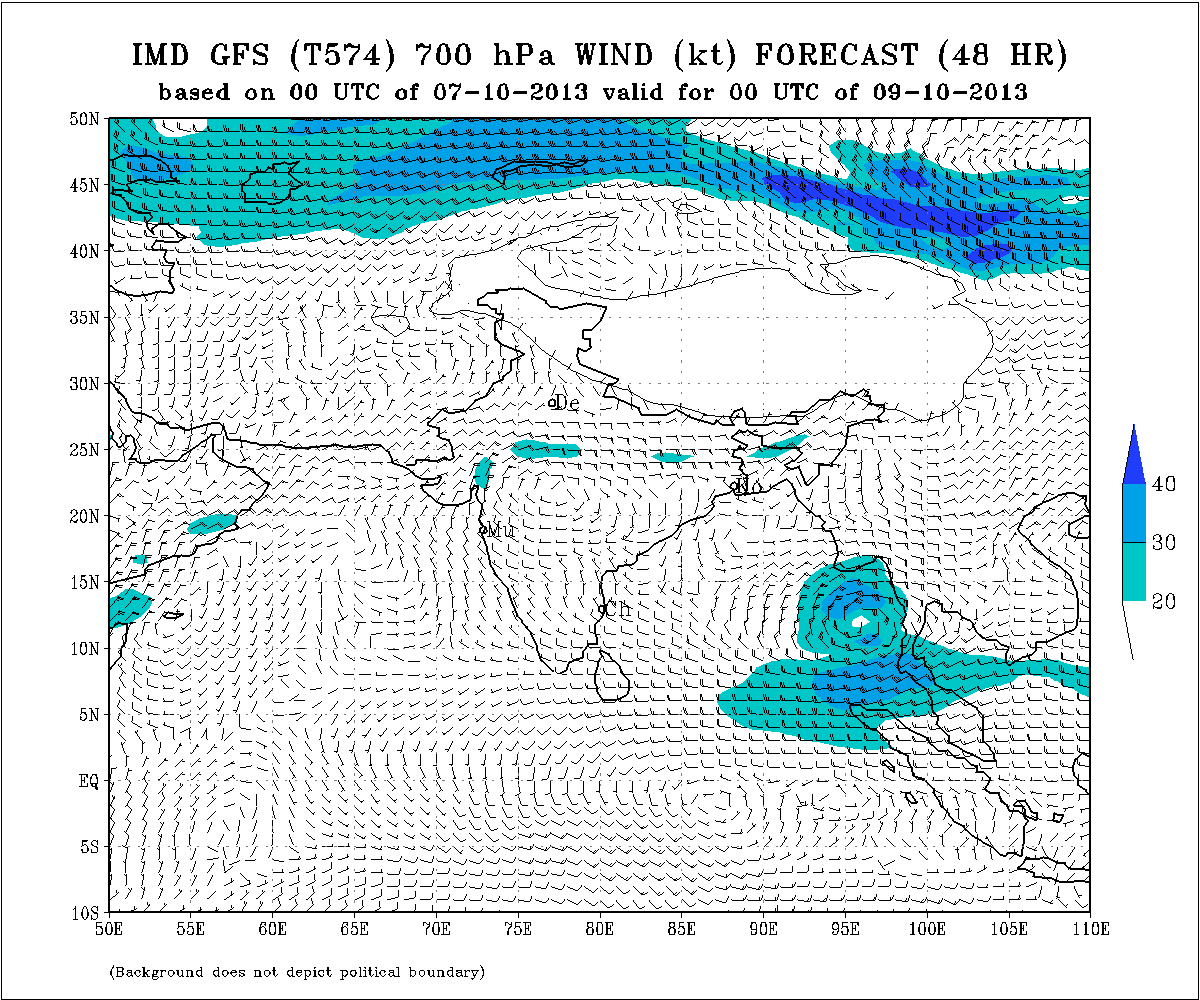
IMD Map Showing UAC at 700 Mb. Over M.P. – Maharashtra Border Areas
Valid 00 UTC 9-10-2013
IMD Map Showing UAC at 700 Mb. Over M.P. – Maharashtra Border Areas
Valid 00 UTC 10-10-2013 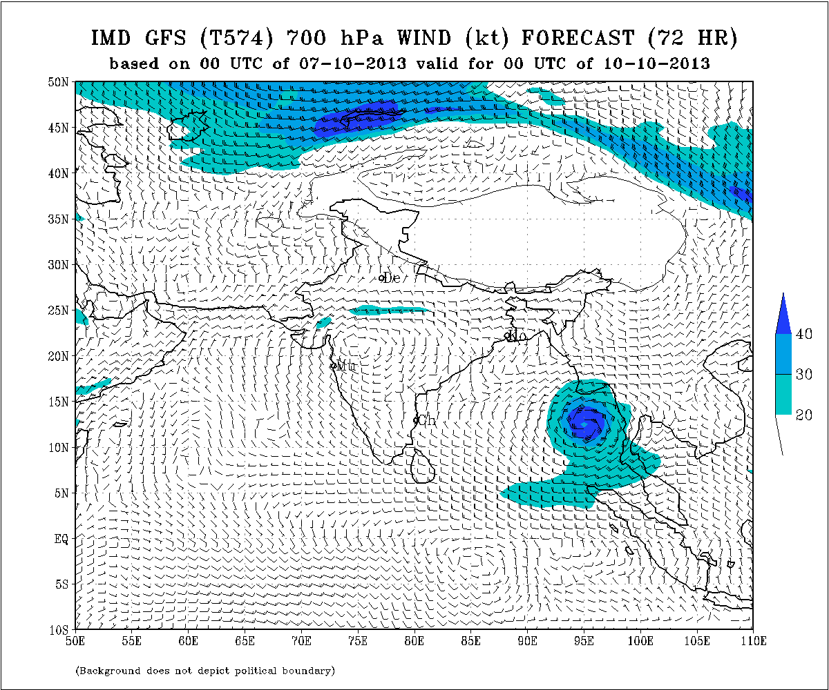
The above two IMD maps also shows the location of the UAC associated with the new Low Pressure System over Bay of Bengal.
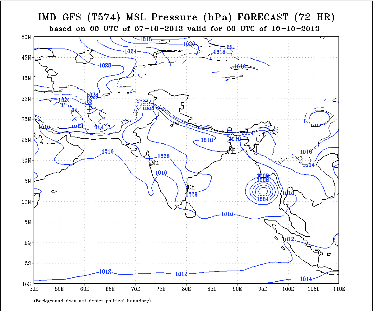
IMD Map Showing Location Of Bay Of Bengal Future Low Pressure
Valid 00 UTC on 10-10-2013
Forecast: 7th to 12th October
South Gujarat & Central Gujarat
Scattered light to medium rainfall on 3 to 4 days of the forecast period.
North Gujarat:
Scattered showers or light rainfall on 2 to 3 days of the forecast period.
Saurashtra:
Bhavnagar, Amreli, Surendranagar & Junagadh Districts are expected to receive scattered showers or light rainfall on many days of the forecast period with more chance on 11th &12th. Rest of Saurashtra expected to receive scattered showers on some days during the forecast period with more chances on 11th 12th October.
Weather Forecast In Akila Daily Dated 7th October 2013 @ 11.00 am.