Current Weather Conditions on 9th August 2014 @ 9.00 pm.
Under the influence of the Upper Air Cyclonic Circulation over the North Bay of Bengal and neighborhood a Low Pressure area has formed over the same region this morning. Associated UAC extends up to 5.8 kms. above mean sea level. The System is currently located over Coastal West Bengal and neighborhood.
The axis of monsoon trough at mean sea level passes through Ganganagar, Narnaul, Agra, Sultanpur, Gaya, Center of Low Pressure area and thence Southeastwards to East Central Bay of Bengal. It extends up to 2.1 kms. above mean sea level.
The off-shore trough at mean sea level continues to run from North Maharashtra coast to Kerala coast.
The Upper Air Cyclonic Circulation over Northeat Rajasthan and neighborhood extending up to 4.5 kms. above mean sea level persists.
The Upper Air Cyclonic Circulation over Kutch & neighborhood at 3.1 Kms. above mean sea level persists.
Due to the UAC over Kutch some benefit to Saurashtra, Kutch & Gujarat.
The Low Pressure of Bay of Bengal is not expected to track towards Saurashtra.
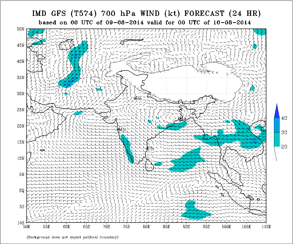
IMD Weather Chart Showing 700 hPa Winds Valid 0000 UTC on 10th August
IMD Weather Chart Showing 700 hPa Winds Valid 0000 UTC on 11th August
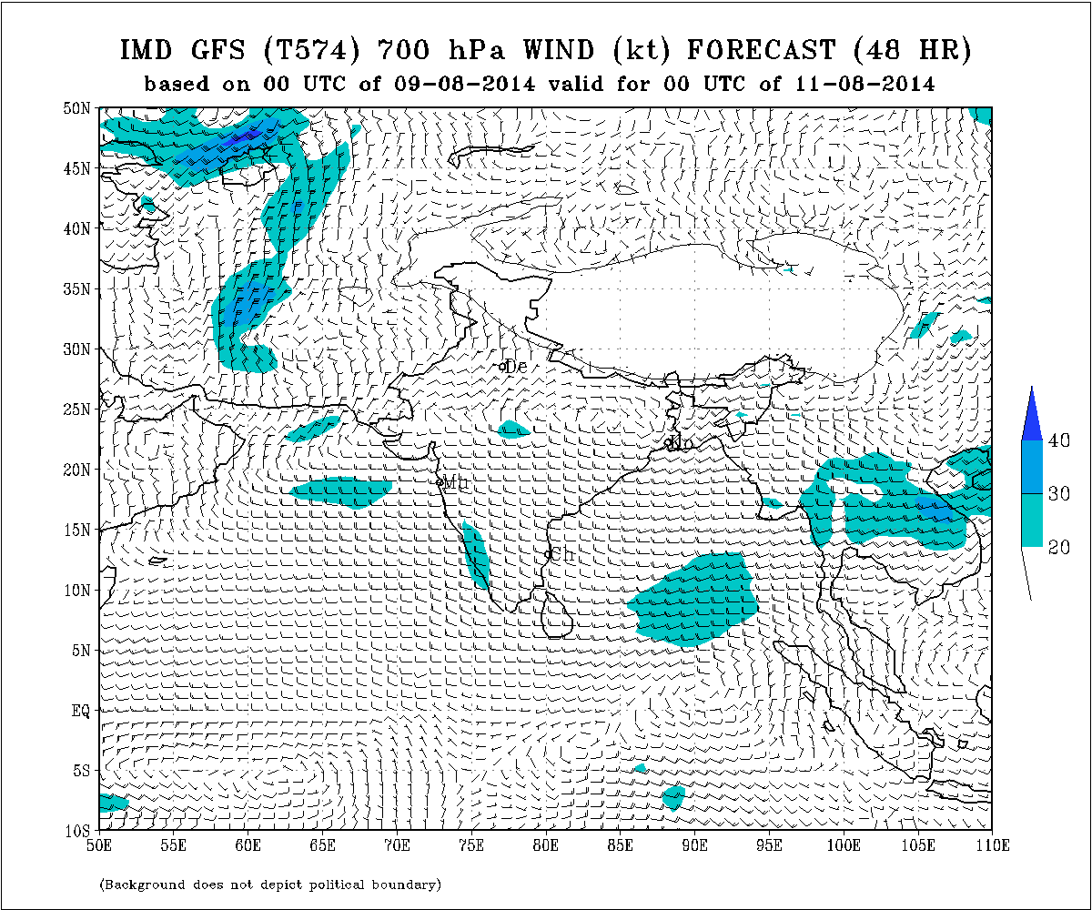
The above chart shows East-West shear zone for a day valid till 0000 UTC 11th August. It is monsoon axis at 3.1 Kms. above mean sea level. This could give rain over some areas along the axis which runs East -West from West Bengal to Kutch.
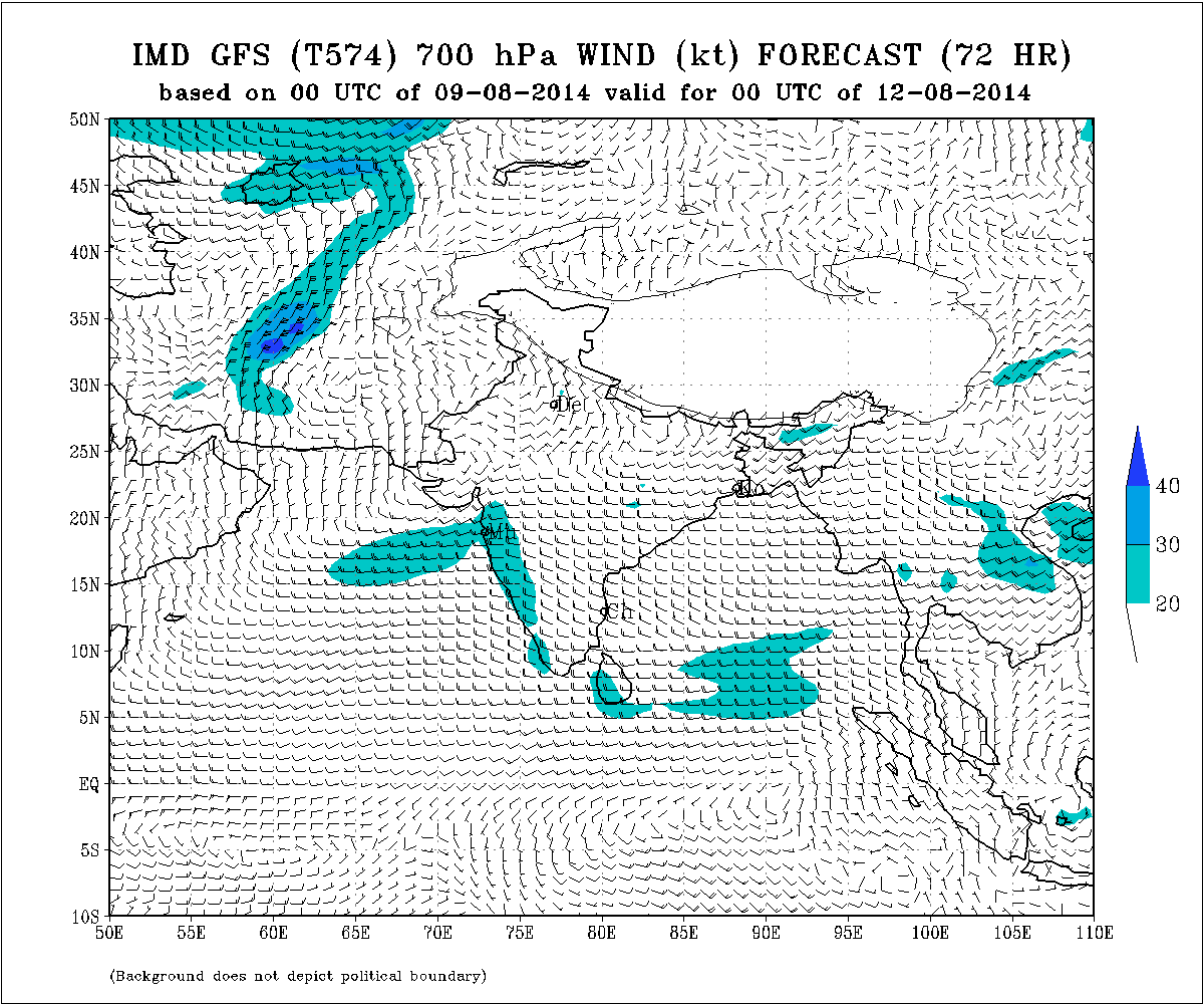
IMD Weather Chart Showing 700 hPa Winds Valid 0000 UTC on 12th August
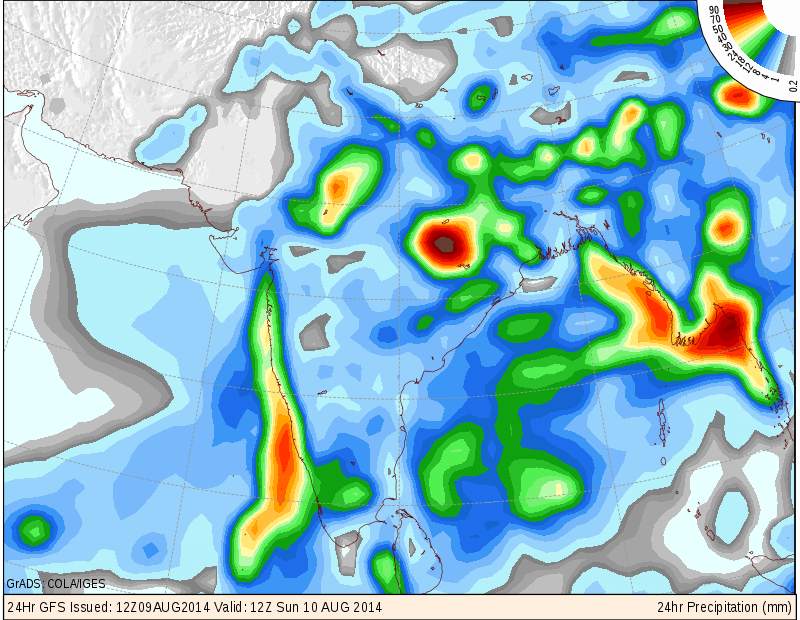
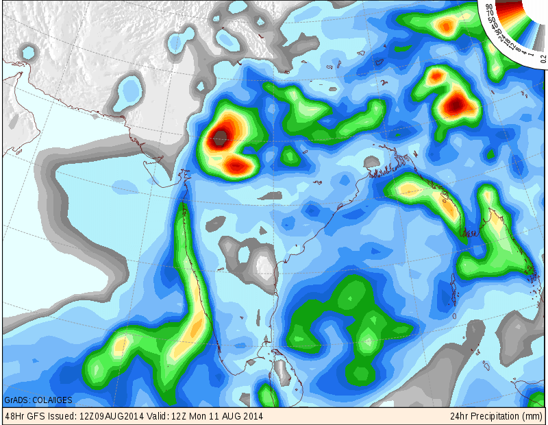
COLA/IGES GFS Precipitation Forecast Map Valid 1200 UTC 10th August 2014 (updated @ 10.30 pm. IST)
COLA/IGES GFS Precipitation Forecast Map Valid 1200 UTC 11th August 2014 (updated at 10.30 pm. IST)
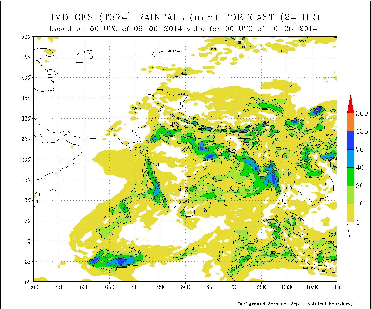
IMD Forecast Rainfall Chart Valid 0000 UTC 10th August 2014
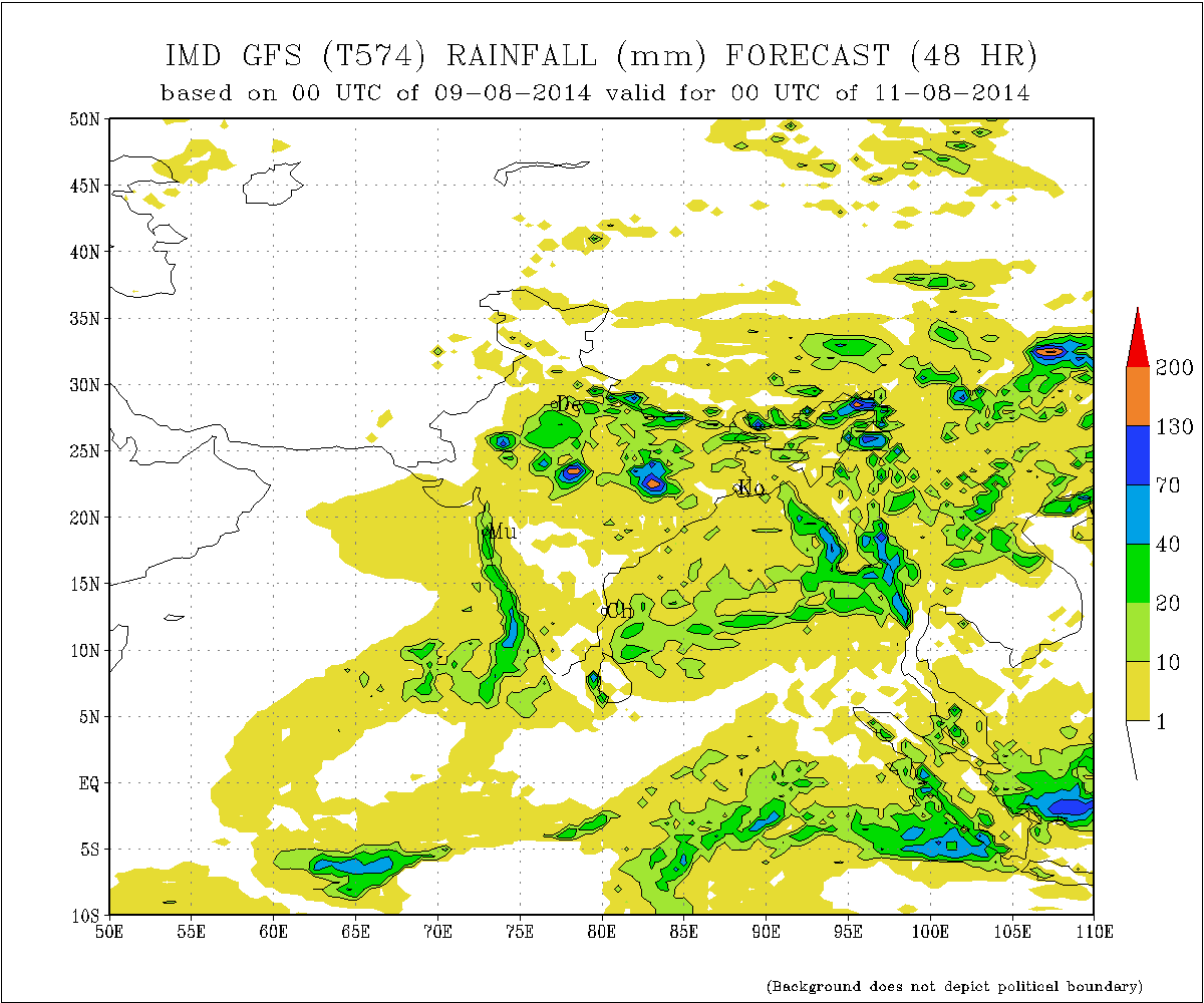
IMD Forecast Rainfall Chart Valid 0000 UTC 11th August 2014
Forecast: 9th August to 14th August 2014
There is an Upper Air Cyclonic Circulation at 700 hPa or 3.1 Kms. above mean sea level over Kutch, Western Saurashtra, Sindh and vicinity which could persist for a day or two. As per 700 hPa chart for 10th August valid till 0000 UTC 11th it shows East-West shear zone for a day. It is monsoon axis at 3.1 Kms. above mean sea level. This could give rain over some areas along the axis which runs East -West from West Bengal to Kutch.
Saurashtra & Kutch :
Scattered light/medium rainfall possible on 9th/10th August.
11th to 14th August there would be scattered showers/light rain but quantity of rain and the area of rain coverage would be less.
Gujarat:
Scattered light/medium rainfall possible on 9th/10th August. There is possibility of medium heavy rainfall over West M.P. so some adjoining areas of Gujarat could get meaningful rain till 11th. Rest of Gujarat there would be scattered showers/light rain but quantity of rain and the area of rain coverage would be less from 11th to 14th August.
બંગાળની ખાડી વાળું નવું લો પ્રેસર હાલ માં પશ્ચિમ બંગાળ ના કાંઠા ના વિસ્તાર આસપાસ છે. હાલ ના અનુમાન મૂજબ તે સીસ્ટમ સૌરાષ્ટ્ર બાજુ આવે તેવું નથી જણાતું.
સૌરાષ્ટ્ર, ગુજરાત અને કચ્છ :
તારીખ ૯ અને ૧૦ ના છૂટો છવાયો હળવો મધ્યમ વરસાદ પડશે.ગુજરાત ના અમૂક વિસ્તાર માં ૧૧ તારીખ સુધી મધ્યમ વરસાદ શક્યતા છે.
તારીખ ૧૧ થી ૧૪ ઓગસ્ટ દરમ્યાન છૂટો છવાયા ઝાપટા અથવા હળવો વરસાદ પડશે પરંતુ વરસાદ ની માત્રા તથા વિસ્તાર ઓછો રહેશે.
Scroll Up