Current Weather Conditions on 16th August 2014 @ 11.00 pm.
The rainfall activity has been less over most parts of Saurashtra, Kutch & North Gujarat. There has been scattered light rain over East Central Gujarat and scattered light to medium rainfall over South Gujarat during last few days.
Detailed Rainfall List for Saurashtra, Kutch & Gujarat till 16th August 2014
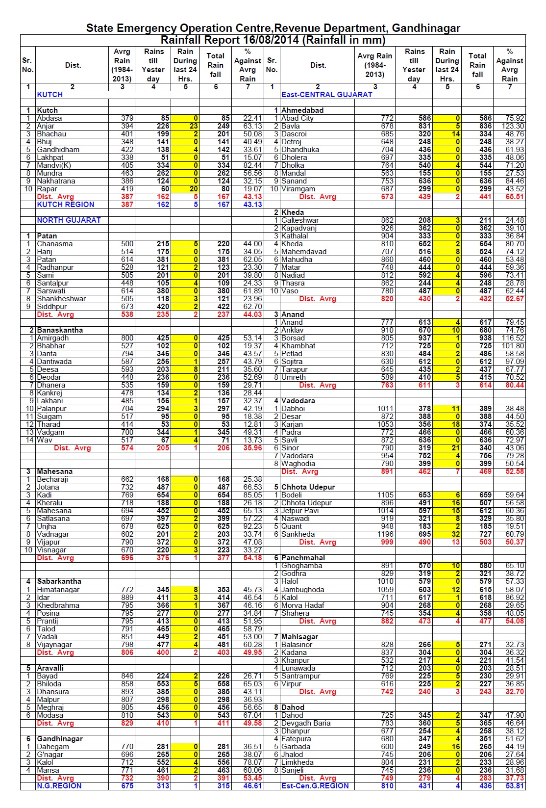

District Wise Rainfall Till 16th August 2014

The axis of monsoon trough at mean sea level passes through Ferozepur, Karnal, Bareily, Bahraich, Patna, Balurghat and thence eastwards to Manipur across Assam & Meghalaya.
An off-shore trough mean sea level from South Maharashtra coast to Kerala coast persists.
The Upper Air Cyclonic Circulation over Sub Himalyan West Bengal & adjoining Bihar extending up to 1.5 Kms. above sea level persists.
The Upper Air Cyclonic Circulation Over North Bay of Bengal & Neighborhood between 5.8 Kms. and 7.6 Kms. above mean sea level persists.
The trough in Mid & Upper Tropospheric Westerlies now runs roughly along 70.0°E and North of Lat. 28.0° N.
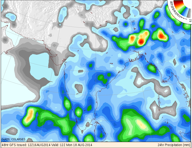
COLA/IGES GFS Precipitation Forecast Map Valid 1200 UTC 18th August 2014
COLA/IGES GFS Precipitation Forecast Map Valid 1200 UTC 19th August 2014

COLA/IGES GFS Precipitation Forecast Map Valid 1200 UTC 20th August 2014

IMD Daily All India Mean Rainfall (mm./day) Forecast Till 23rd August

The above rainfall graph shows that rainfall activity over whole India will be less than normal during 18th to 21st August and the rainfall activity expected to pick up from 22nd./23rd August.
Forecast: 17th August to 22nd August 2014
Saurashtra, Gujarat & Kutch :
17th August there would be scattered showers/light rain but quantity of rain and the area of rain coverage would be less.
18th to 22nd August most parts of Saurashtra, Kutch & Gujarat would be mainly dry with occasional showers. South Gujarat and some parts of Central Gujarat could get off & on scattered light rain/showers during the forecast period.
Any UAC or Low Pressure System expected to form over the BAy of Bengal is not expected to affect Saurashtra, Gujarat & Kutch.
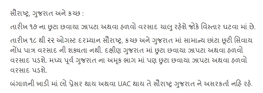
સૌરાષ્ટ્ર, ગુજરાત અને કચ્છ :
તારીખ ૧૭ ના છુટા છવાયા ઝાપટા અથવા હળવો વરસાદ ચાલુ રહેશે જોકે વિસ્તાર ઘટવા માં છે.
તારીખ ૧૮ થી ૨૨ ઓગસ્ટ દરમ્યાન સૌરાષ્ટ્ર, કચ્છ અને ગુજરાત માં સામાન્ય છાંટા છૂટી સિવાય નોંધ પાત્ર વરસાદ ની શક્યતા નથી. દક્ષીણ ગુજરાત માં છુટા છવાયા ઝાપટા અથવા હળવો વરસાદ પડશે. મધ્ય પૂર્વ ગુજરાત ના અમૂક ભાગ માં પણ છુટા છવાયા ઝાપટા અથવા હળવો વરસાદ પડશે.
બંગાળની ખાડી માં લો પ્રેસર થાય અથવા UAC થાય તે સૌરાષ્ટ્ર ગુજરાત ને અસરકર્તા નહિ રહે.
Scroll Up