Current Weather Conditions on 29th August 2014 @ 6.00 pm.
The rainfall activity had improved from 23rd August on wards and light to medium rainfall has been reported from many places in Gujarat & Saurashtra.
The Low Pressure over West Central & Adjoining Northwest Bay of Bengal off North Andhra Pradesh- South Odisha coast has strengthened to a Well Marked Low Pressure. Associated Upper Air Cyclonic Circulation extends up to Mid-Tropospheric level tilting Southwards with height. It is expected to strengthen further as it tracks inland.
The Western end of Monsoon trough has shifted Southwards and now it passes through Jaisalmer, Kota, Narsinghpur, Jagdalpur, Center of Well Marked Low Pressure area and thence East Southeastwards to East Central Bay of Bengal.
The Off-shore trough at mean sea level is active from Goa coast to Kerala coast.
The Western disturbance as an Upper Air Cyclonic Circulation over North Pakistan & adjoining Jammu & Kashmir extends up to Mid-Tropospheric persists.
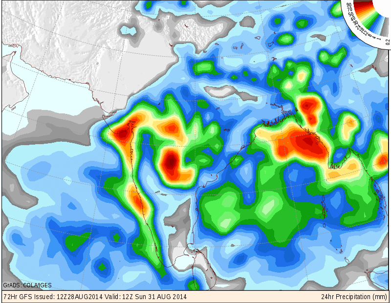
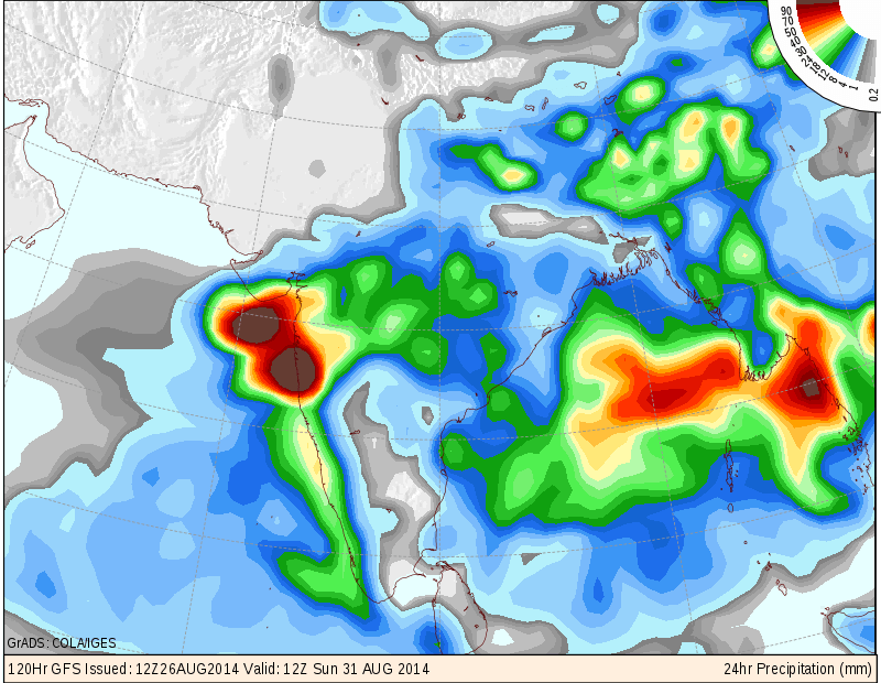
COLA/IGES GFS Precipitation Forecast Map Valid 1200 UTC 31st August 2014
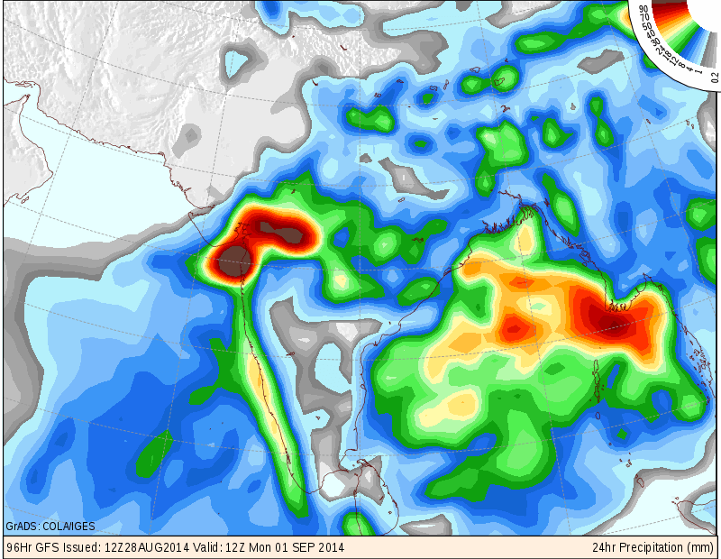
COLA/IGES GFS Precipitation Forecast Map Valid 1200 UTC 1st September 2014
COLA/IGES GFS Precipitation Forecast Map Valid 1200 UTC 2nd September 2014

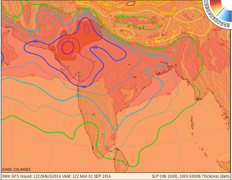
COLA/IGES SLP Forecast Map Valid 1200 UTC 1st September 2014
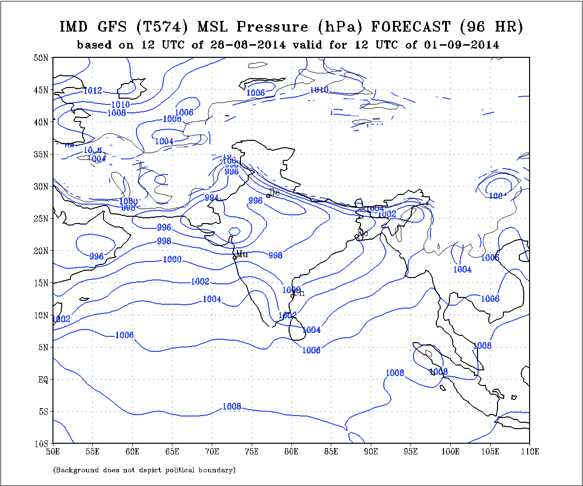
IMD MSL Pressure Forecast Map Valid for 1200 UTC 28th August 2014
IMD Daily All India Mean Rainfall (mm./day) Forecast Till 4th September 2014
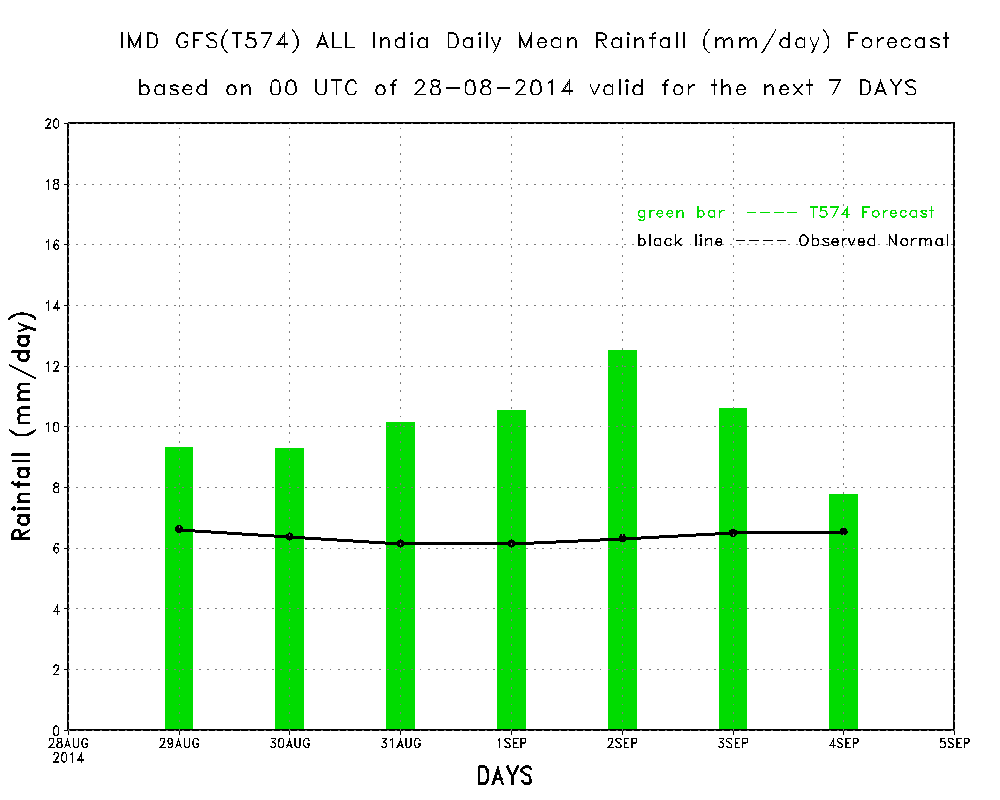
The above rainfall graph shows that rainfall activity over whole India average will be very good for the week 28th August to 4th September. Overall above average rainfall expected for India for week ending 4th September.
Forecast: 29th August to 2nd September 2014
Saurashtra, Gujarat & Kutch :
The Well Marked Low Pressure System will track mainly West Northwestwards and strengthen further as it tracks inland towards Maharashtra and finally track towards Gujarat & vicinity.
Major portion of Saurashtra & Gujarat expected to get medium to heavy rainfall during the forecast period while some parts of Saurashtra & Gujarat would get light to medium rainfall. Kutch is also expected to get light to medium rainfall from this round.
Overall looking at the current forecast models this round of rainfall will be above average.
NOTE: On Vacation so post will be put if time permits !
સૌરાષ્ટ્ર, ગુજરાત અને કચ્છ :
તારીખ ૨૯ ઓગસ્ટ થી ૨ સપ્ટેમ્બર ૨૦૧૪:
બંગાળની ખાડી નું વેલ માર્કડ લો પ્રેસર મુખ્યતે પશ્ચિમ ઊત્તર પશ્ચિમ તરફ ગતિ કરશે અને હજુ મજબૂત થઇ શકે છે.
સૌરાષ્ટ્ર અને ગુજરાત ના મોટા ભાગ માં મધ્યમ અને ભારે વરસાદ થશે બાકી ના સૌરાષ્ટ્ર અને ગુજરાત ના વિસ્તારો માં તેમજ કચ્છ માં હળવો મધ્યમ વરસાદ થશે.
વિવિદ્ધ ફોરકાસ્ટ મોડલ આધારિત માહિતી પ્રમાણે આ રાઉન્ડ માં સૌરાષ્ટ્ર, ગુજરાત અને કચ્છ માં વરસાદ ની વધુ આશા છે.
નોંધ: રજા માં બહાર ગામ હોવા થી નવી અપડેટ માટે વેળા મોડું ગણવું તેમજ પોસ્ટ ના જવાબ પણ વેળા મોડા મળશે.
Scroll Up