Current Weather Conditions on 24th October 2014 @ 7.30 am.
From IMD Inference issued at 1910 hours IST 23rd October:
The Well Marked Low Pressure area over Southeast & Adjoining East Central Arabian Sea Persists. The System would concentrate into a Depression during next 24 hours. It is likely to move initially in a Northwest direction and subsequently may intensify into a Cyclonic Storm.
Associated Upper Air Cyclonic Circulation extending up to Mid-Tropospheric level also persists.
The Upper Air Cyclonic Circulation over Srilanka and adjoining gulf of Mannar extending up to 0.9 km. above mean sea level persists.
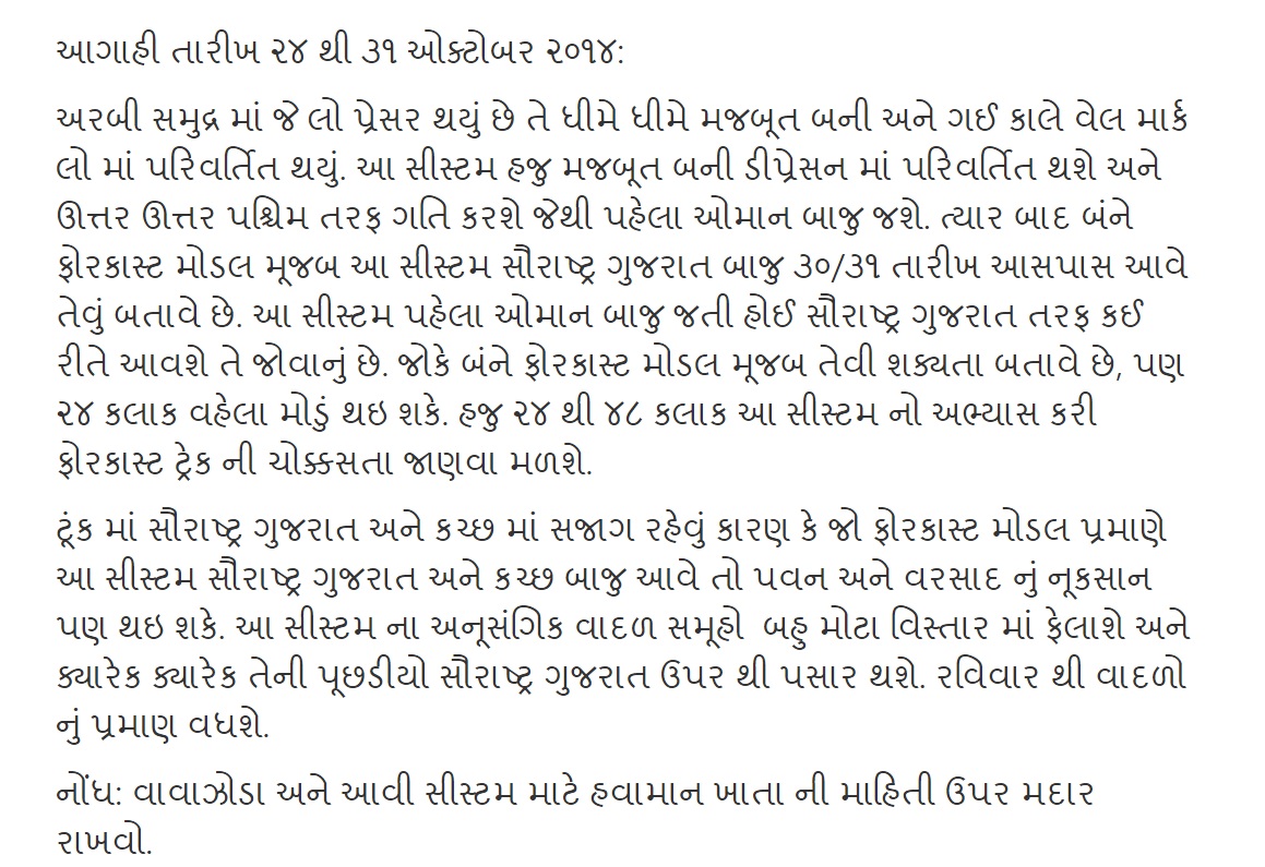
Observing the GFS MSLP charts the Low Pressure area is now at 1006 millibars.
IMD GFS (T574) MSLP Forecast Chart Valid 23rd October 2014 @ 12 UTC
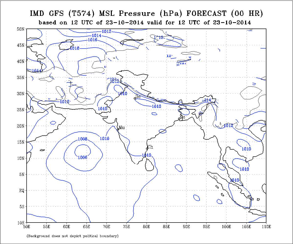
This system is being monitored by NRL as 90A.INVEST. Current location is Lat. 12.7 N & Long. 61.5 E with 25 knots and 1006 mb. in the West Central Arabian Sea.
NRL IR Satellite Image Dated 24th Ocotber 2014 @ 0130 UTC
The Well Marked Low Pressure is expected to concentrate into a Depression within 24 hours and subsequently intensify two notches into a Cyclonic Storm as it tracks initially North Northwestwards towards Oman.
24 Hours Earlier Wunderground ECMWF 925 hPa Forecat Chart
Valid 30th October 00 UTC
(based on ECMWF Forecast run dated 22nd October 12 UTC)
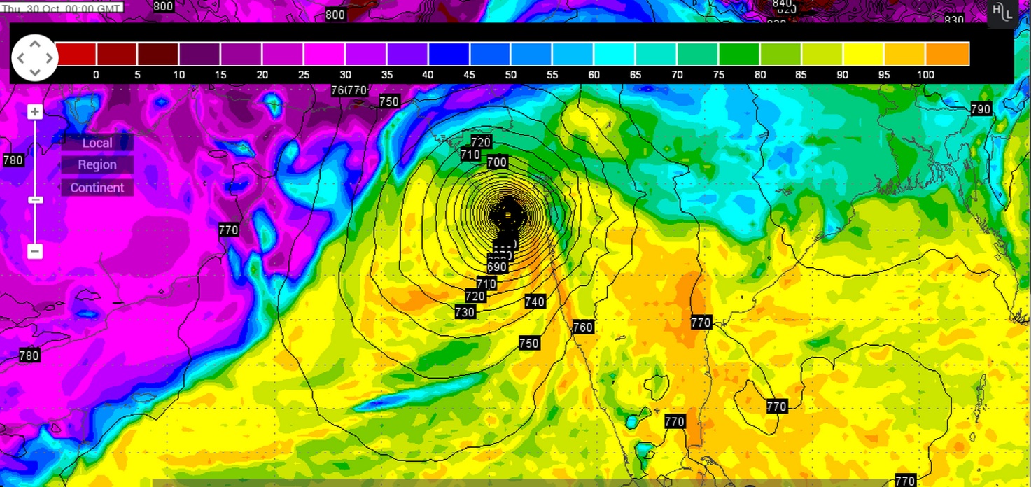
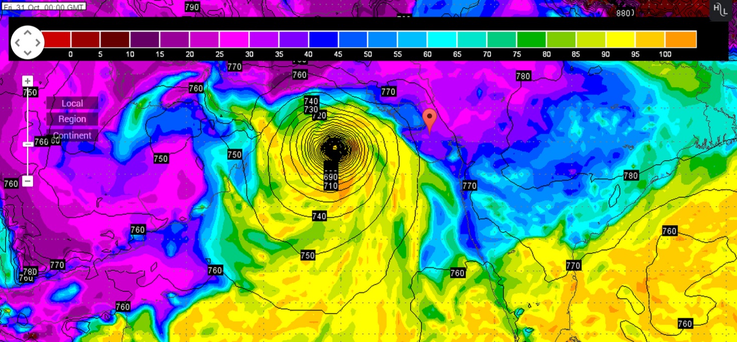
Latest Wunderground ECMWF 925 hPa Forecat Chart Valid 31st October 00 UTC
(based on ECMWF Forecast run dated 23rd October 12 UTC)
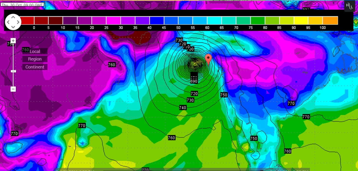
Latest Wunderground GFS 925 hPa Forecat Chart Valid 30th October 09 UTC
(based on GFS Forecast run dated 23rd October 12 UTC)
Forecast Track By IMD Multi Model Ensemble (MME)

Forecast: 24th to 31st October 2014
ECMWF & GSF are now having similar outcome for the System developing in the South Arabian Sea. GFS is consistent with the forecast track compared to 24 hours earlier, however, the latest ECMWF shows that it would take more time to reach towards Saurashtra Gujarat compared to 24 hours ago forecast track. This System is expected to become a Cyclonic Storm and if the track towards Gujarat & Saurashtra materializes, farmers should be cautious. Western Disturbance as well as future WD during the forecast period could affect the final outcome this System. Forecast outcome can change and updates will be given as and when available.