Current Weather Conditions on 26th May 2015
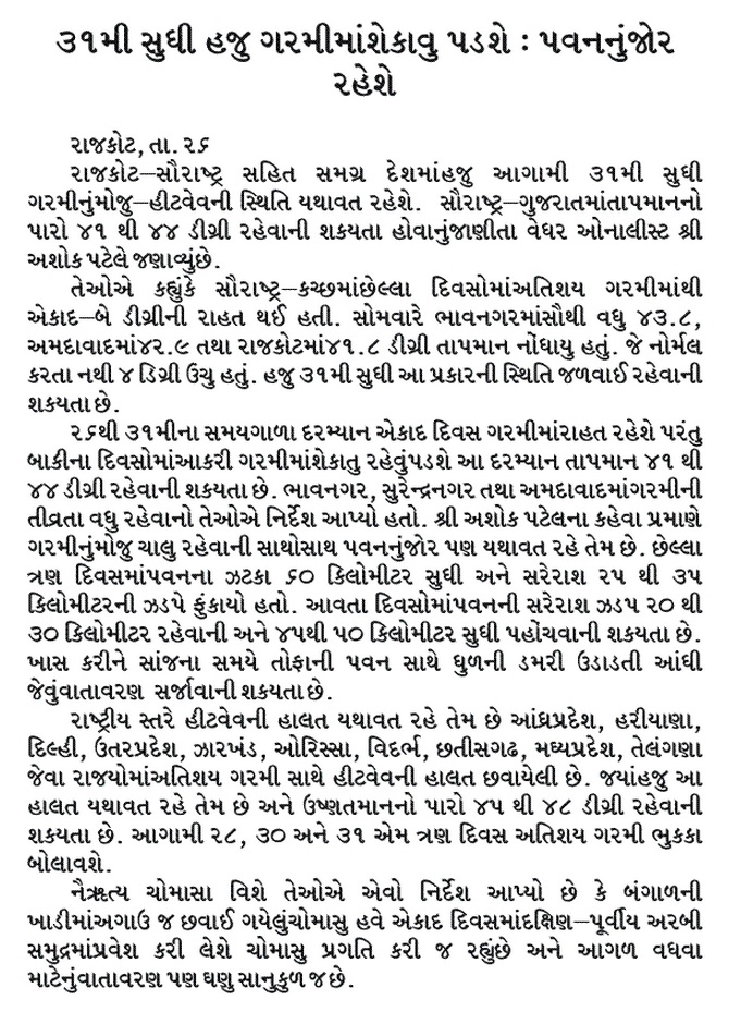
Maximum Temperature over Saurashtra, Gujarat & Kutch have maintained the 41-44 range over many centers. Ahmedabad recorded 43.9 C, Surendranagar 43.3 C & Rajkot was 42.0 C on 26th May.
The Maximum Temperature today for locations over Saurashtra, Gujarat & Kutch were as follows :
Saurashtra, Gujarat & Kutch – Stations 26th May 2015 |
Maximum |
Temperature |
|
(oC) |
|
|
|
|
Ahmedabad |
43.9 |
Surendranagar |
43.3 |
Gandhinagar |
42.8 |
Deesa |
42 |
Rajkot |
42 |
Bhavnagar |
42 |
Idar |
41.8 |
Amreli |
41.3 |
Kandla (Airport) |
40.1 |
Vadodara |
39.6 |
Bhuj |
38.5 |
New Kandla |
37.3 |
Valsad |
36.9 |
Mahuva |
35.8 |
Diu |
35.5 |
Naliya |
35 |
Surat |
34.8 |
Porbandar |
34.5 |
Okha |
34 |
Kutch-Mandvi |
33.7 |
Veraval |
33.5 |
Dwarka |
32.6 |
Hot Centers (Major) Of India
Daltonganj (India) 46.8 °C
Rentachintala (India) 46.8 °C (Yesterday)
Machilipatnam (India) 46.4 °C
Nagpur Sonegaon (India) 46.2 °C
Agra (India) 46.1 °C
Pbo Raipur (India) 46.1 °C
Jharsuguda (India) 46.0 °C
Forecast: 26th May to 31st May 2015
Saurashtra, Gujarat & Kutch:
Hot weather will continue over Saurashtra, Gujarat & Kutch till 31st May and the Maximum Temperature over hot centers will range between 41-44 C. The Maximum Temperature in the Districts of Ahmedabad, Surendranagar & Bhavnagar will be higher than rest of Gujarat. The afternoon/evening humidity is expected to increase further thereby increasing the Heat Index. Generally there will be windy weather in evening.
Rest Of India :
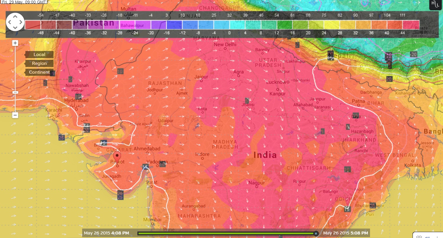
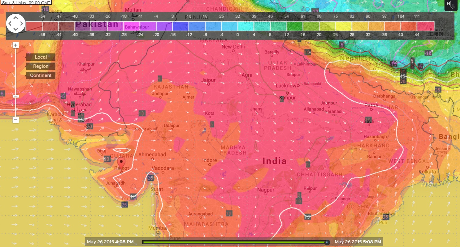
Heat wave conditions are expected over various States such as North Rajathan, Haryana, Delhi, U.P. Jharkhand, Chhatishgarh, Odisha, Telangana/A.P., Madhya Pradesh, Vidarbha. The Heat wave conditions will be pockets of different areas and dates during the forecast period. The Maximum Temperature will range from 45 C to 48 C in hot centers. The Wunderground Maps shows the Hot Areas on various days.
Wunderground Map showing Forecast Temperature at 0900 UTC
(02.30 pm.) on 29th May 2015
Wunderground Map showing Forecast Temperature at 0900 UTC
(02.30 pm.) on 31st May 2015
Monsoon Progress:
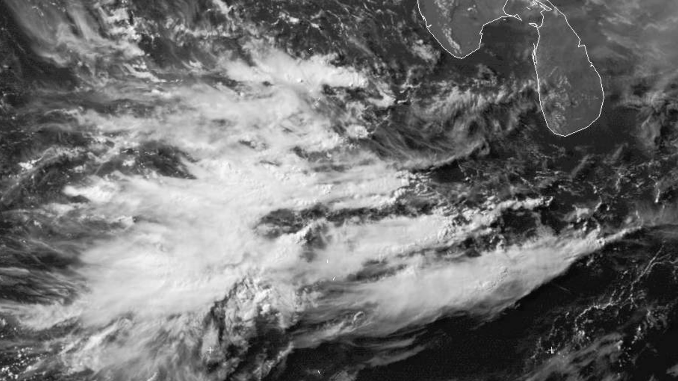
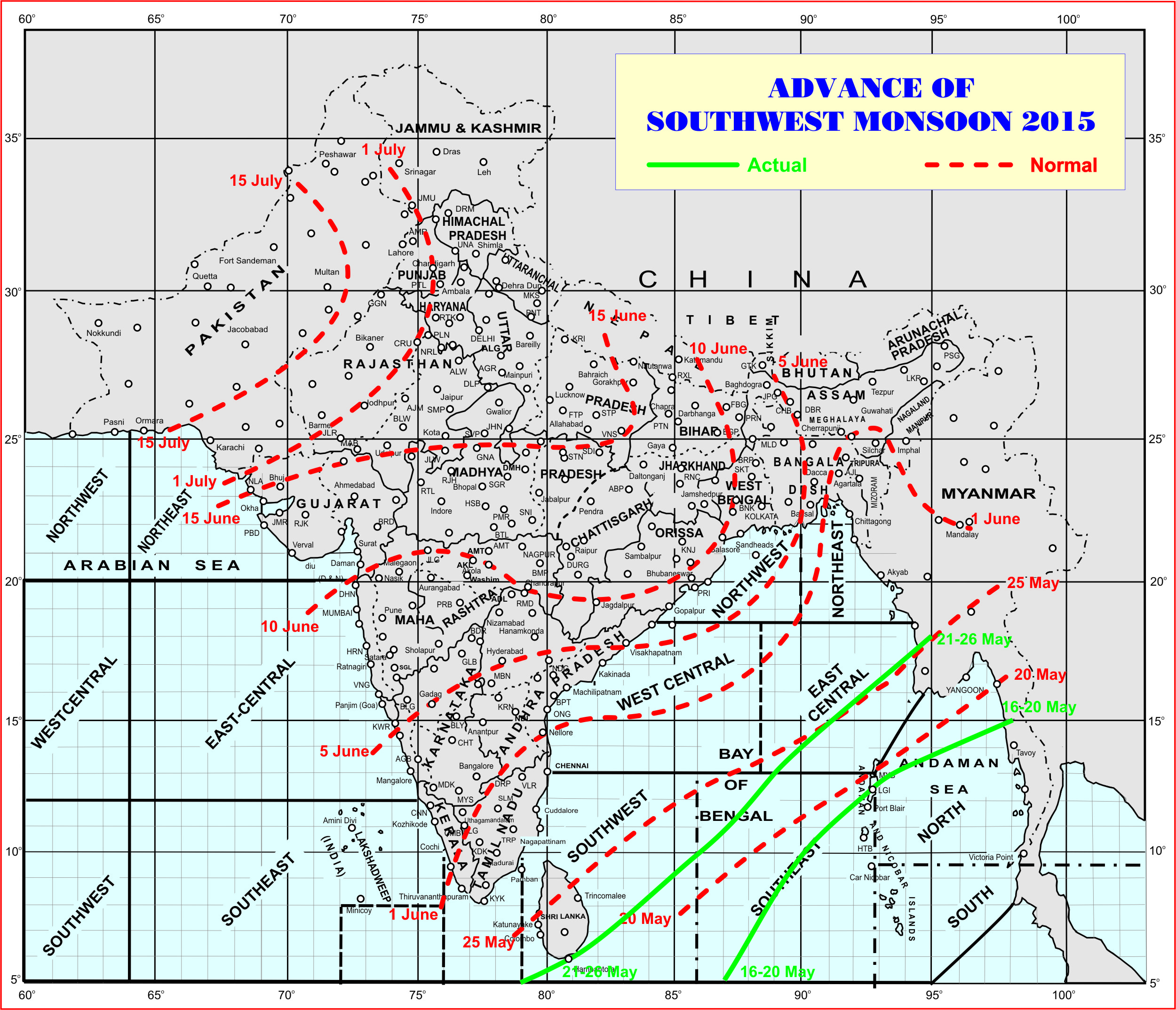
The conditions are improving for advancement of Southwest Monsoon into the Southern parts of the Southeastern Arabian, Maldives, Comorin area and some parts of South & Central Bay of Bengal during the next 24 hours.
Dundee Visible Satellite Image Dated 26th May 1200 UTC
Showing Monsoon Clouds Approaching Comorin Area
Advance Of Southwest Monsoon Over India Till 26th May 2015
