Current Weather Conditions on 22nd June 2015
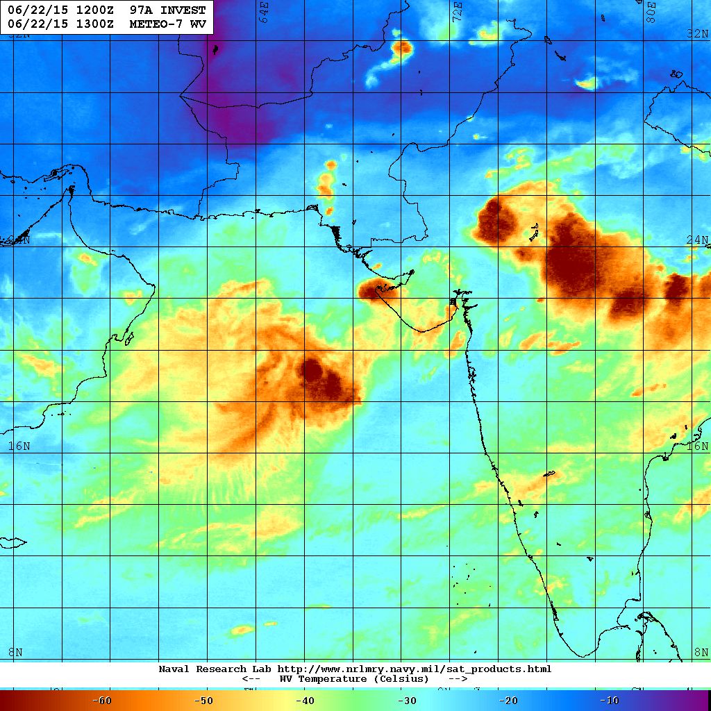
The Well marked Low Pressure over the North East Arabian & Adjoining East Central Arabian Sea concentrated to a Depression over the same region this morning. The location is about 300 Kms. Southwest from Porbandar. The dense clouding associated with this System are mainly located to the West of the System Center. This Depression could strengthen further to a Deep Depression in next 36 hours.
Update will be given if any major changes occur
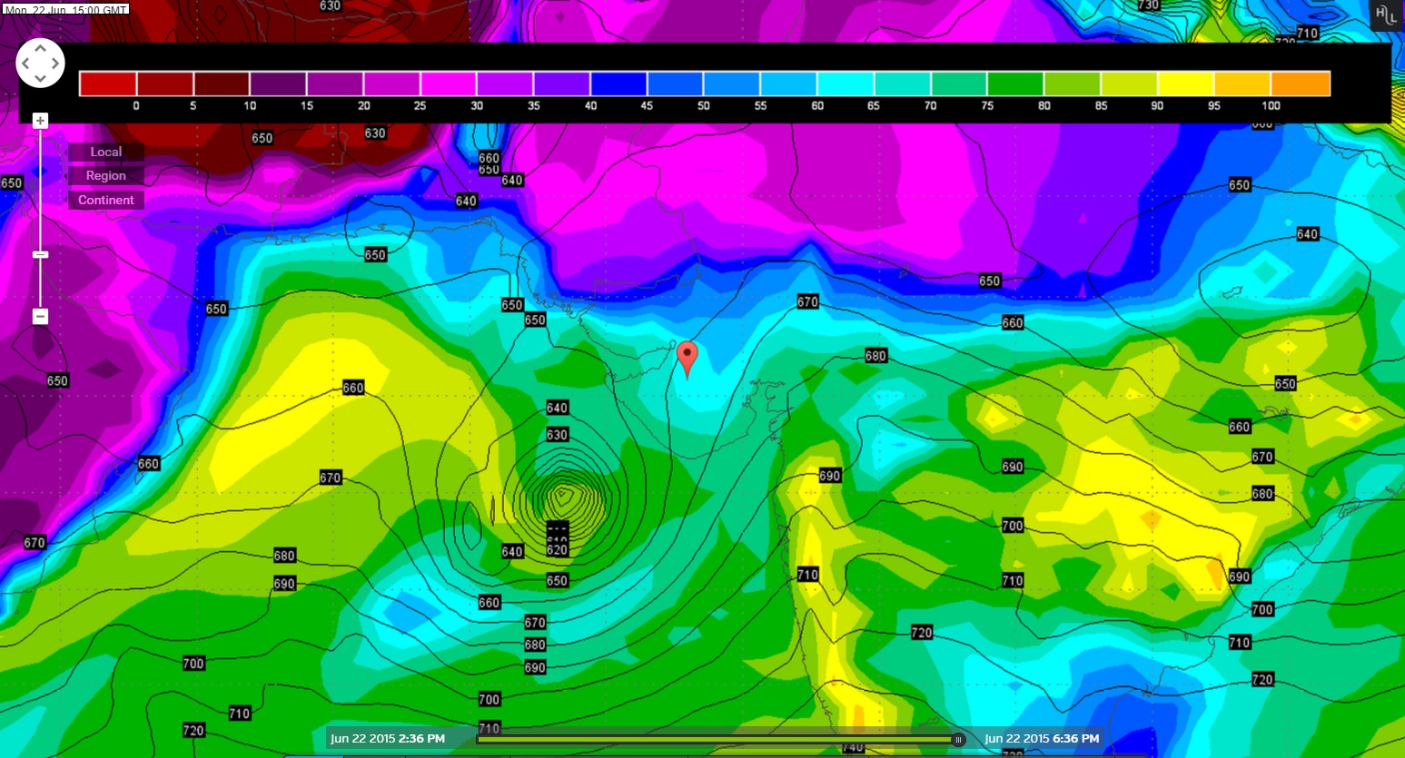
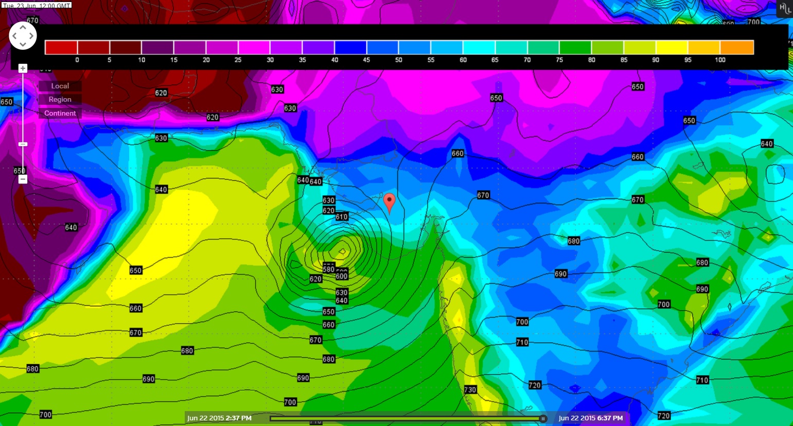
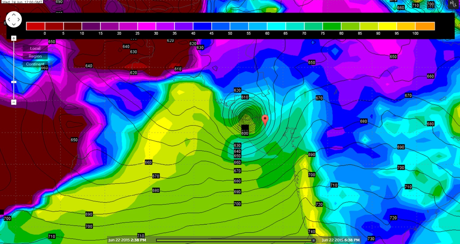
Yesterday we have concluded that the GFS model outcome would stand validated and hence going by that here under is next three days Forecast location of the Arabian Sea System.
Wunderground GFS 925 hPa Chart Valid 22nd June 2015 @ 1500 UTC
Wunderground GFS 925 hPa Chart Valid 23rd June 2015 @ 1200 UTC
Wunderground GFS 925 hPa Chart Valid 24th June 2015 @ 1200 UTC
From IMD Inference on 22nd June issued at 1630 IST based on observations of 1230 IST:
The Depression over over northeast & adjoining eastcentral Arabian sea remained practically stationary and lay centered at 1430 hours IST of today, near 20° North and Longitude 67.0°East about 320 km from southwest of Porbandar. The System is likely to move slowly in west-northwestwards and concentrate into a Deep Depression during next 24 hours.
REGIONAL SPECIALISED METEOROLOGICAL CENTRE-TROPICAL CYCLONES, NEW DELHI SPECIAL TROPICAL WEATHER OUTLOOK
22nd June 2015 1500 UTC Outlook click the link RSMC-New Delhi Outlook
Note: 1 knot =1.852 Kms.
JTWC Reissued at 22nd June 0500z
ABIO10 PGTW 220500
MSGID/GENADMIN/JOINT TYPHOON WRNCEN PEARL HARBOR HI//
SUBJ/SIGNIFICANT TROPICAL WEATHER ADVISORY FOR THE INDIAN OCEAN
/REISSUED/220500Z-221800ZJUN2015//
RMKS/
1. NORTH INDIAN OCEAN AREA (MALAY PENINSULA WEST TO COAST OF AFRICA):
   A. TROPICAL CYCLONE SUMMARY: NONE.
   B. TROPICAL DISTURBANCE SUMMARY:
      (1) THE AREA OF CONVECTION PREVIOUSLY LOCATED NEAR 20.2N
68.2E, IS NOW LOCATED NEAR 19.9N 67.7E, APPROXIMATELY 295 NM SOUTH
OF KARACHI, PAKISTAN. ANIMATED MULTISPECTRAL SATELLITE IMAGERY
DEPICTS DEEPENED CONVECTION SLIGHTLY SHEARED TO THE WEST OF A
DEVELOPING LLCC. A 220312Z SSMIS MICROWAVE IMAGE REVEALS THE BULK
OF THE DEEP CONVECTION DISPLACED WEST OF THE LLCC. A 220142Z WINDSAT
PASS SHOWS A 25 TO 30 KNOT CIRCULATION CENTER WITH STRONGER (UP TO
GALE FORCE) WINDS ASSOCIATED WITH SOUTHWESTERLY MONSOONAL FLOW TO
THE SOUTH OF THE CENTER. UPPER-LEVEL ANALYSIS INDICATES THE
DISTURBANCE IS LOCATED IN AN AREA OF MODERATE VERTICAL WIND SHEAR
AND GOOD DIFFLUENT OUTFLOW. MAXIMUM SUSTAINED SURFACE WINDS ARE
ESTIMATED AT 25 TO 30 KNOTS. MINIMUM SEA LEVEL PRESSURE IS ESTIMATED
TO BE NEAR 990 MB. DUE TO PERSISTENT DEEP CONVECTION AND IMPROVED
LLCC ORGANIZATION, THE POTENTIAL FOR THE DEVELOPMENT OF A
SIGNIFICANT TROPICAL CYCLONE WITHIN THE NEXT 24 HOURS IS UPGRADED TO
MEDIUM.
      (2) NO OTHER SUSPECT AREAS.
2. SOUTH INDIAN OCEAN AREA (135E WEST TO COAST OF AFRICA):
   A. TROPICAL CYCLONE SUMMARY: NONE.
   B. TROPICAL DISTURBANCE SUMMARY: NONE.
3. JUSTIFICATION FOR REISSUE: UPGRADED AREA IN PARA 1.B.(1) TO
MEDIUM//
NNNN
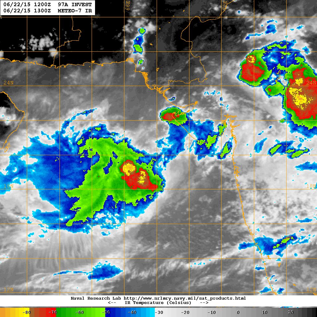
NRL IR Satellite Image on 22nd June 2015 @ 1300 UTC ( 6.30 pm. IST)
NRL Water Vapor Satellite Image on 22nd June 2015 @ 1300 UTC ( 06.30 pm. IST)
Forecast: 22nd June to 26th June 2015
Saurashtra, Kutch & Gujarat
The Rainfall amount and areas will vary on day to day basis as the System tracks towards/over Saurashtra/Kutch/North Gujarat during 22nd June to 26th June of which very heavy rainfall in some areas between these dates.
ટૂકું તને ટચ : ઊત્તર પૂર્વ અને લાગુ મધ્ય પૂર્વ અરબી સમુદ્ર માં ડીપ્રેસન છે જે પોરબંદર થી 300 કિમી દક્ષીણ પશ્ચિમે છે.
હાલ નું નિદાન: આ સીસ્ટમ પહેલા 12 કલાક ત્યાંજ રહેશે ત્યાર બાદ સૌરાષ્ટ્ર તરફ અને પછી કચ્છ તરફ આવશે તેવું અનુમાન છે. 24 કલાક માં ફેર ફાર હશે અપડેટ થશે.
ચોમાસું હવે બેસવા ના સંજોગો થયા છે. સૌરાષ્ટ્ર, કચ્છ અને ગુજરાત ના મોટા વિસ્તાર માં ચોમાસું નોતું બેઠું, ભલે છૂટો છવાયો સારો વરસાદ થઇ ગયો હોઈ. ક્યાં કેટલો વરસાદ થાય તે નક્કી ના હોઈ કારણ કે આ વરસાદ હાલ સીસ્ટમ આધારિત છે.
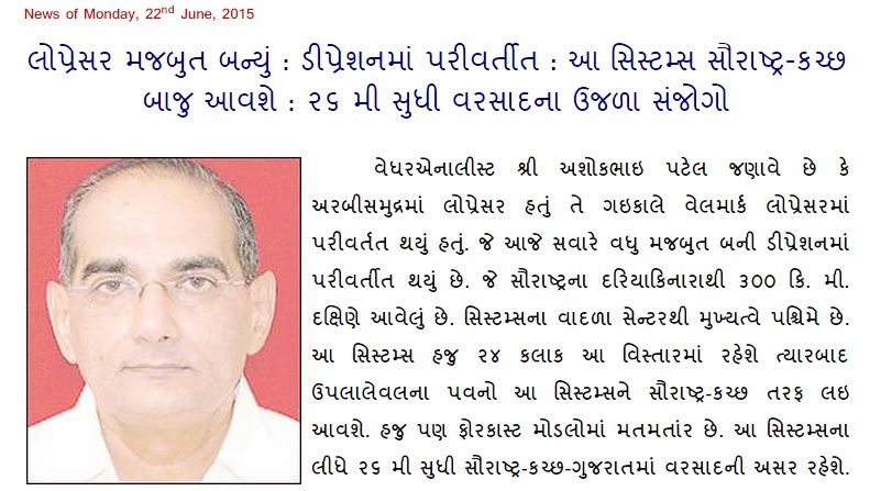
Weather Forecast In Akila Daily Dated 22nd June 2015
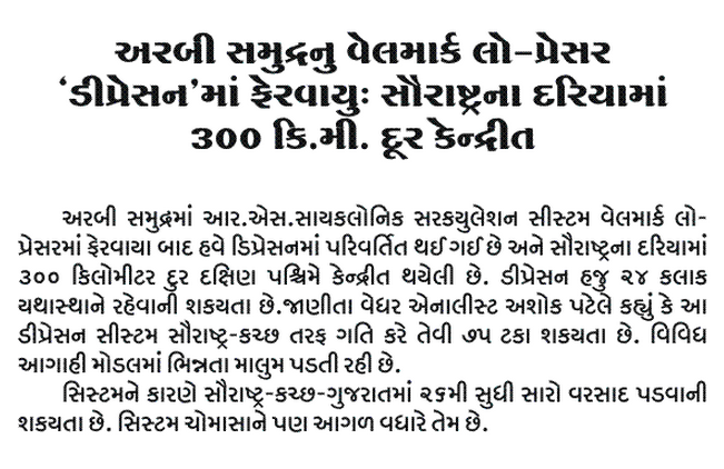
Weather Forecast In Sanj Samachar Daily Dated 22nd June 2015
Caution:
Please refer/rely on IMD/RSMC Bulletins/Advisories for Storms & Weather related matter.
સાવચેતી:
સ્ટોર્મ કે હવામાન અંગે ની માહિતી માટે ભારતીય હવામાન ખાતા/ગવર્મેન્ટ ના બુલેટીન/સુચના પર નિર્ભર રહેવું.