Current Weather Conditions on 13th August 2015 @ 7.30 pm. IST
The Low Pressure area has tracked over Chhatishgarh and is now over Southeast Madhya Pradesh and adjoining Vidarbha & South Chhattisgarh. The associated Upper Air Cyclonic Circulation extends upto 7.6 km above mean sea level.
The Axis of Monsoon trough continue to pass through Bikaner, Jaipur, Guna, Center of Low Pressure area over Southeast Madhya Pradesh and adjoining Vidarbha & South Chhattisgarh, Gopalpur and thence Southeastwards to East Central Bay of Bengal and extends upto 1.5 km above mean sea level.
The Western Disturbance as an Upper Air trough in Mid-Tropospheric Westerlies roughly along Longitude 71.0°E and North of Latitude 32.0°N persists.
An Upper Air Cyclonic Circulation over Saurashtra & Kutch and adjoining Northeast Arabian Sea persists at 3.1 km above mean sea level and is expected to remain in the vicinity of Saurashtra & Kutch and adjoining Northeast Arabian Sea for 2-3 days.
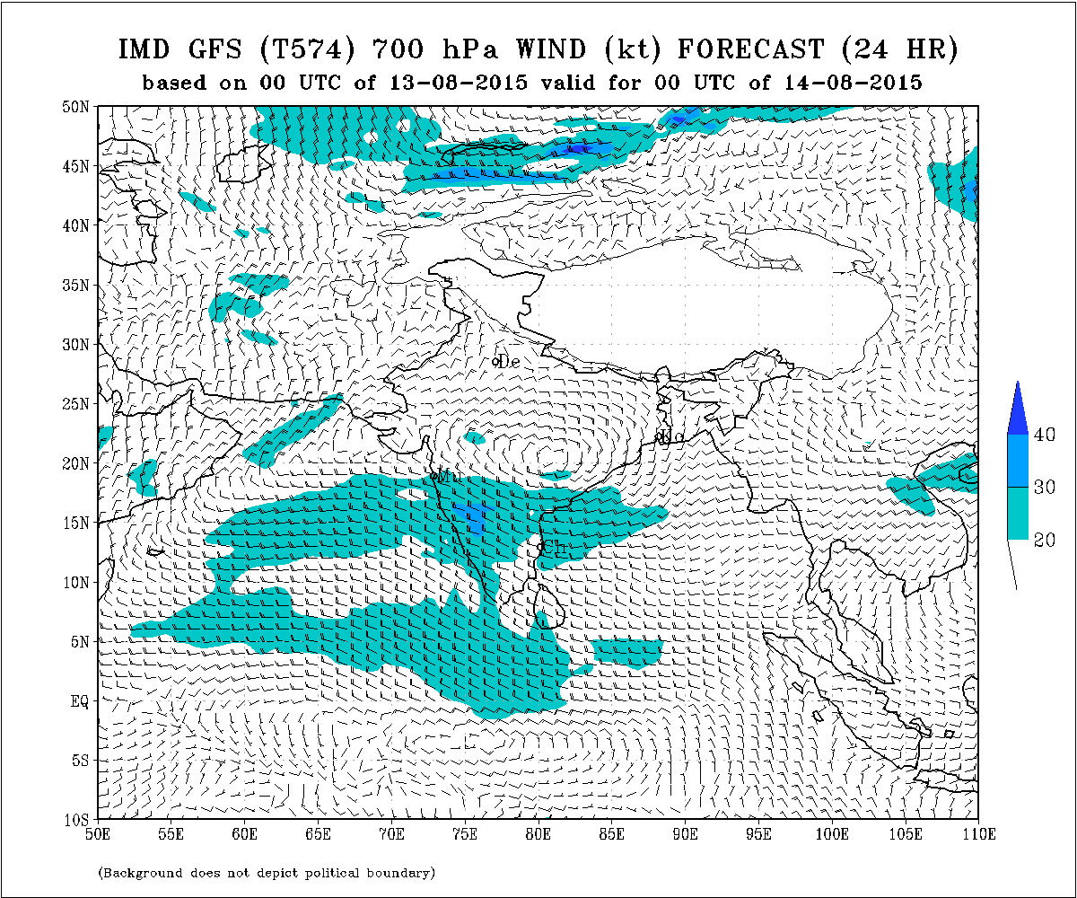
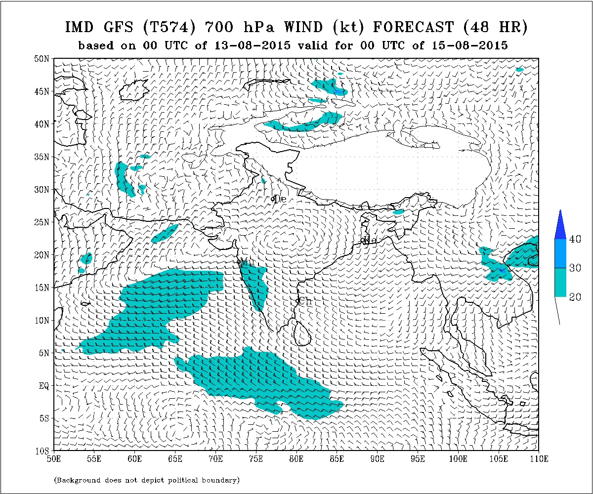
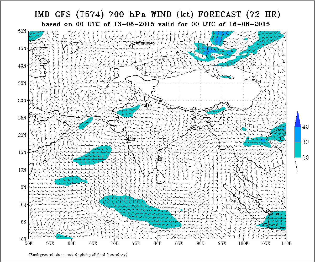
There would be a broad Upper level Circulation at 700 hPa like the Axis of Monsoon at 3.1 Km. & it would extend from the UAC over Saurashtra/Kutch to the UAC of the Low Pressure area over East M.P./Vidarbha as can be seen from the IMD Weather charts below:
IMD GFS (T574) 700 hPa Wind Forecast Valid for oo UTC 14-08-2015
IMD GFS (T574) 700 hPa Wind Forecast Valid for oo UTC 15-08-2015
IMD GFS (T574) 700 hPa Wind Forecast Valid for oo UTC 16-08-2015
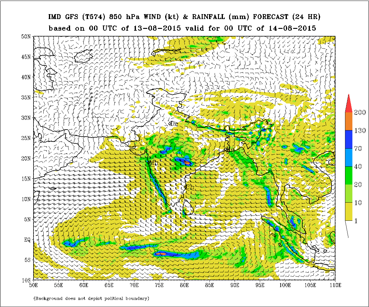
IMD GFS (T574) 850 hPa Winds & Rainfall (mm.) Forecast (24 Hours)
based on 00 UTC of 13-08-2015 valid for 00 UTC of 14-08-2015
IMD GFS (T574) 850 hPa Winds & Rainfall (mm.) Forecast (24 Hours)
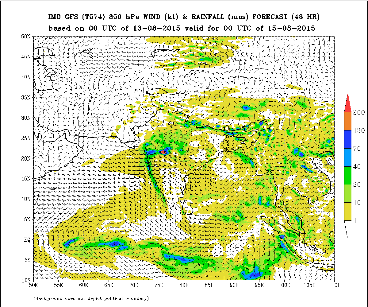
based on 00 UTC of 13-08-2015 valid for 00 UTC of 15-08-2015
IMD GFS (T574) 850 hPa Winds & Rainfall (mm.) Forecast (24 Hours)
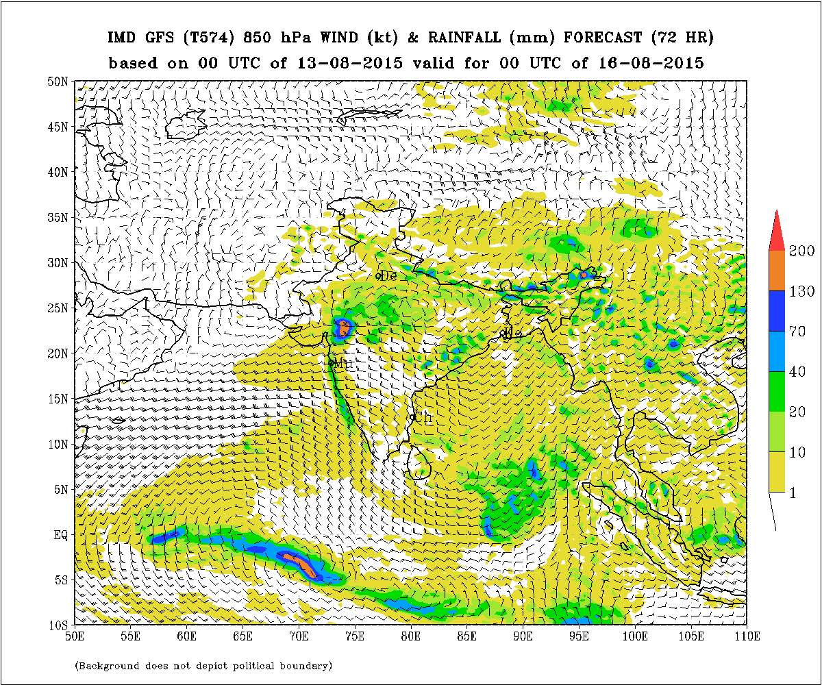
based on 00 UTC of 13-08-2015 valid for 00 UTC of 16-08-2015
Forecast: 13th August to 17th August 2015
Saurashtra, Kutch & Gujarat
Medium to heavy rainfall is already being reported for many centers of Border areas of Gujarat near West Madhya Pradesh as well as border areas of Gujarat near South Rajasthan.
Overall Gujarat will receive more quantum of rain meaning medium to heavy rain compared to Forecast two days ago, especially Border areas of Gujarat near West Madhya Pradesh as well as border areas of Gujarat near South Rajasthan. Overall Gujarat light to medium to heavy rain in this round for Gujarat.
Currently there would be partly cloudy weather and scattered light to medium rain on most days during the forecast period for Saurashtra with some areas of Saurashtra getting medium rain.
સૌરાષ્ટ્ર કચ્છ ગુજરાત:
તારીખ 13 ઓગસ્ટ થી 17 ઓગસ્ટ 2015
સૌરાષ્ટ્ર અને કચ્છ અને લાગુ ઊત્તર પૂર્વ અરબી સમુદ્ર નજીક નું UAC હજુ 2-3 દિવસ રહેશે. હાલ બંગાળની ખાડી વાળું લો પ્રેસર પૂર્વ એમ પી સુધી પોંચેલ છે. તે લો પ્રેસર વાળું UAC અને સૌરાષ્ટ્ર લચ્છ નજીક નું UAC 3.1 કિમી માં ધરી જેવું બહોળું સર્ક્યુલેસન ફેલાશે.
પશ્ચિમ એમ. પી. અને દક્ષીણ રાજસ્થાન ને લાગુ ગુજરાત ના બોર્ડેર વિસ્તારો ના અમૂક સેન્ટરો માં મધ્યમ ભારે વરસાદ ના રીપોર્ટ છે. આ રાઉન્ડ માં ગુજરાત માં વરસાદ ની માત્રા બે દિવસ પહેલા કરેલ આગાહી થી વધુ રહેશે, ખાસ કરીને પશ્ચિમ એમ. પી. અને દક્ષીણ રાજસ્થાન ને લાગુ ગુજરાત ના બોર્ડેર વિસ્તારો.
સૌરાષ્ટ્ર માં અંશત વાદળ છાયું વાતાવરણ રહેશે તેમજ છૂટો છવાયો હળવો વરસાદ તેમજ અમૂક વિસ્તારો માં મધ્યમ વરસાદ ની શક્યતા આગાહી સમય ગાળા માં છે.
.
Scroll Up