Current Weather Conditions on 10th November @ 8.00 am. IST
Observations & Outcome:
Very Severe Cyclonic Storm “MEGH” over Westcentral Arabian Sea has weakened to Depression strength during the last 24 hours and has made landfall over Yemen close to Aden today 10th November at 00 UTC.
The Deep Depression over Southwest Bay Of Bengal made landfall over Tamilnadu coast close to Puducherry yesterday evening and is tracking Westwards and has weakened to a Low Pressure now. This System is being monitored as 96B.INVEST location Lat. 12.5N & Long. 77.8 E. with 20 knots winds and 1007 mb. Central Pressure. This System is expected to re-emerge over the East Arabian Sea.
The System that is expected to re-emerge over the East Arabian Sea is expected to track Westwards and so will not come close to Saurashtra, Gujarat & Kutch and is also not expected to affect Saurashtra, Gujarat & Kutch. Some Peripheral clouding could come over these areas but will not affect these regions.
JTWC Tropical Cyclone 05A (Five) Final Warning #20
on 10th Nov. 2015 @ 0300 UTC

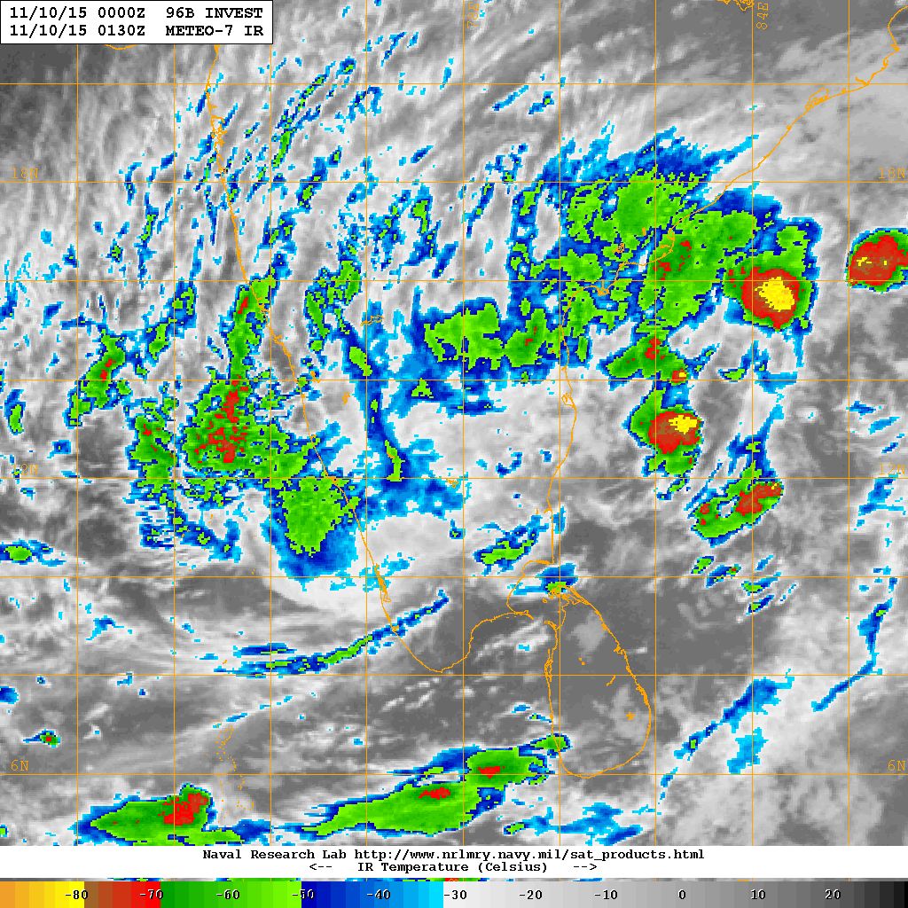
05A.MEGH Over Westcentral Arabian Sea Location 13.0 N. & 45.1 E. with winds of 35 knots & 996 millibar Central Pressure on 10th November NRL IR Satellite Image @ 0130 UTC

96B.INVEST Over Southern Indian Peninsula Location 12.5 N. & 77.8 E. with winds of 20 knots & 1007 millibar Central Pressure on 10th November NRL IR Satellite Image @ 0130 UTC
Caution:
Please refer/rely on IMD/RSMC Bulletins/Advisories for Storms & Weather related matter.
અપડેટ તારીખ 10 નવેમ્બર 2015 સવારે 8.00 કલાકે:
અરબી સમુદ્ર નું અતિ તીવ્ર વાવાઝોડું “MEGH” મુખ્યત્વે પશ્ચિમ તરફ ગતિ કરેલ અને છેલા 24 કલાક માં નબળું પડેલ અને આજે સવારે 00 UTC યેમેન ઉપર અનાદ થી નજીક ડીપ્રેસન ની માત્રા થી ત્રાટકેલ છે.
બંગાળ ની ખાડી નું ડીપ ડીપ્રેસન તમિલનાડુ ઉપર ગઈ કાલે ત્રાટકેલ અને નબળું પડી ને પશ્ચિમ તરફ ગતિ કરે છે. આ લો પ્રેસર 24 થી 48 કલાક માં અરબી સમુદ્ર માં દાખલ થશે.
આ સીસ્ટમ સૌરાષ્ટ્ર, ગુજરાત અને કચ્છ બાજુ નહિ આવે પણ ક્યારેક પૂછડિયા વાદળો આવશે જે ખાસ અસર નહિ કરે.
સાવચેતી:
સ્ટોર્મ કે હવામાન અંગે ની માહિતી માટે ભારતીય હવામાન ખાતા/ગવર્મેન્ટ ના બુલેટીન/સુચના પર નિર્ભર રહેવું.
Scroll Up