Current Weather Conditions on 12th December 2016
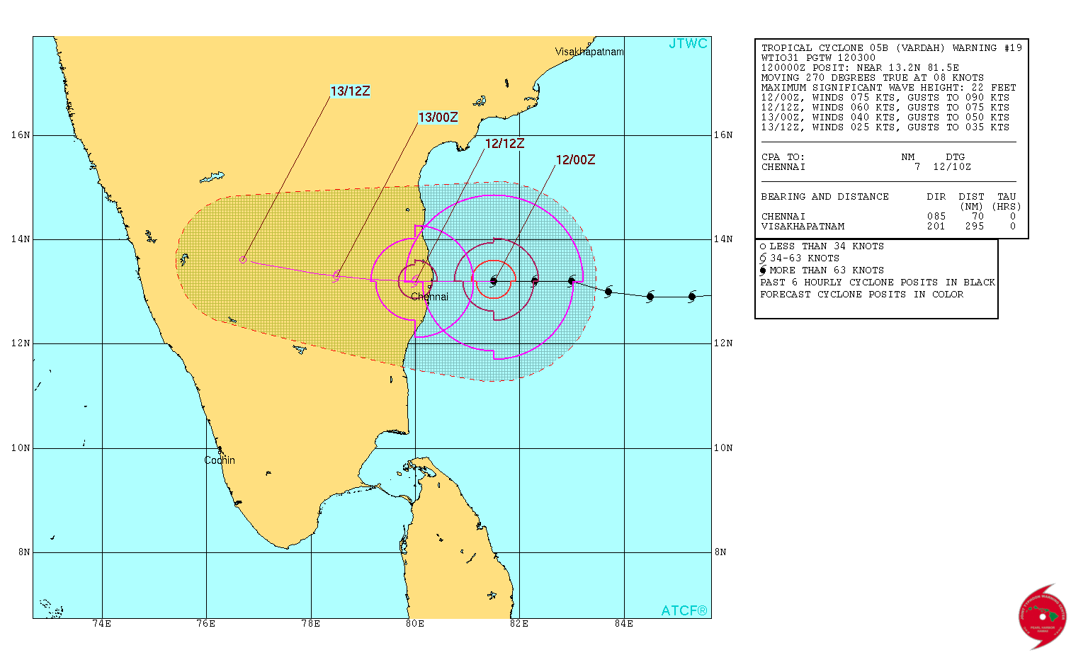
The Very Severe Cyclonic Storm, VARDAH over West Central and adjoining South Bay of Bengal moved further Westwards and is located at Latitude 13.25ºN and Longitude 80.75ºE at 0430 UTC (11.00 IST), about 55 km from Chennai as per UW-CIMSS Landfall expected over North Tamilnadu coast near Chennai around 3.00 pm. IST today the 12th December 2016.
1 knot= 1.85 km./hour
JTWC Tropical Cyclone 05B.VARDAH (Very Severe Cyclonic STorm “VARDAH”) Warning No. 19
Issued at 0300 UTC on 12th December 2016
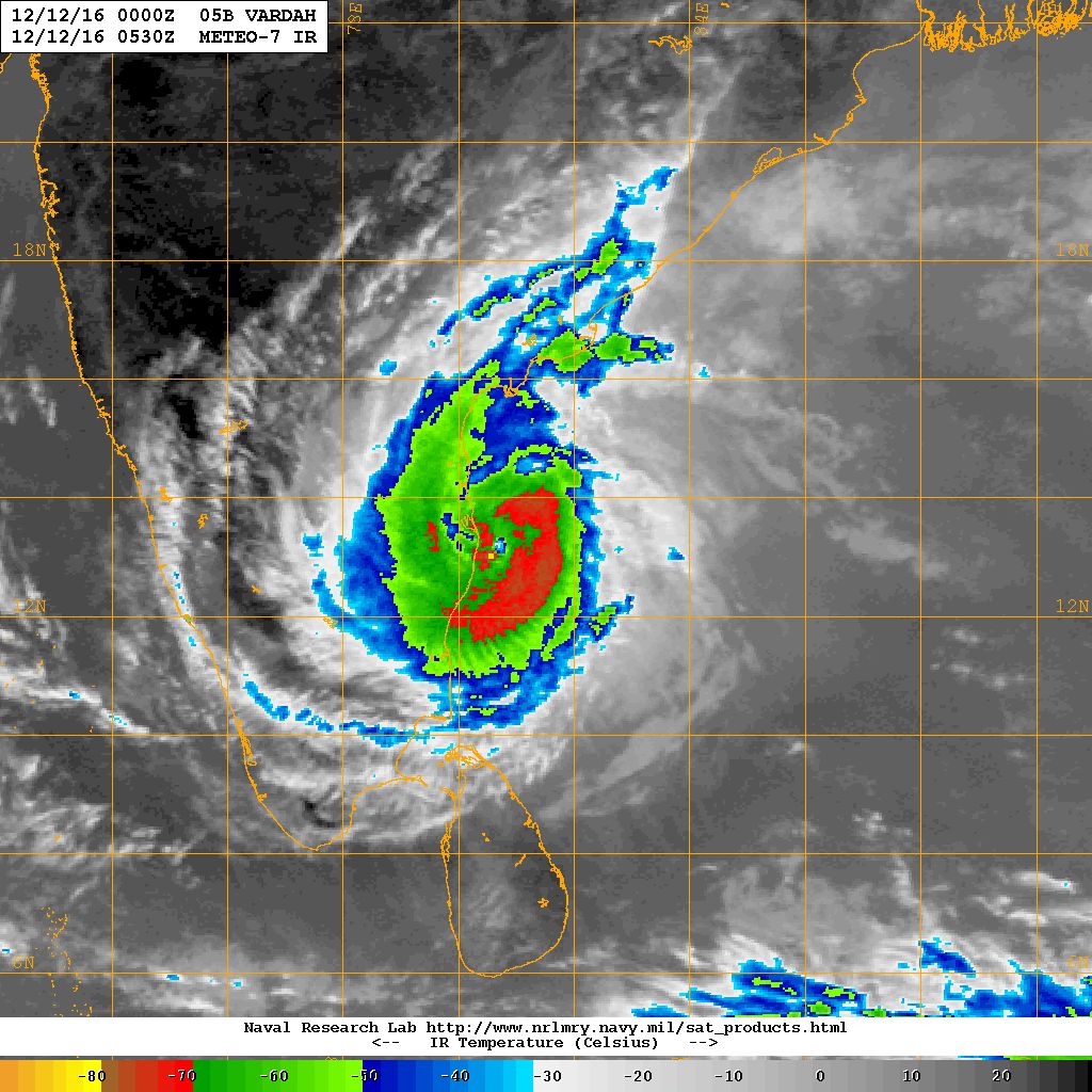
NRL IR Satellite Image of 05B.VARDAH (Very Severe Cyclonic Storm “VARDAH”)
on 12th December 2016 @ 0530 UTC (11.00 am. IST)
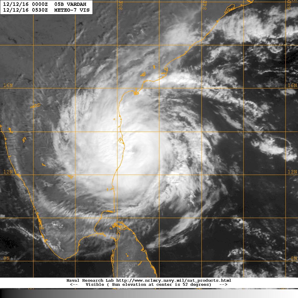
NRL Water Visible Satellite Image of 05B.VARDAH (Very Severe Cyclonic Storm “VARDAH”)
on 12th December 2016 @ 0530 UTC (11.00 am. IST)
| UW-CIMSS Automated Satellite-Based Advanced Dvorak Technique (ADT) Version 8.2.1 Tropical Cyclone Intensity Estimation Algorithm |
|
| Current Intensity Analysis | |
                     UW - CIMSS
              ADVANCED DVORAK TECHNIQUE
                  ADT-Version 8.2.1
         Tropical Cyclone Intensity Algorithm

             ----- Current Analysis -----
     Date :  12 DEC 2016    Time :   043000 UTC
      Lat :   13:14:56 N     Lon :   80:45:17 E


                CI# /Pressure/ Vmax
                4.1 / 985.3mb/ 67.4kt


             Final T#  Adj T#  Raw T#
                3.8     4.2     5.6

 Estimated radius of max. wind based on IR : 12 km

 Center Temp : -22.5C    Cloud Region Temp : -68.9C

 Scene Type : EYE

 Positioning Method : SPIRAL ANALYSIS

 Ocean Basin : INDIAN
 Dvorak CI > MSLP Conversion Used : CKZ Method

 Tno/CI Rules : Constraint Limits : 0.5T/hour
                   Weakening Flag : ON
           Rapid Dissipation Flag : OFF

 C/K/Z MSLP Estimate Inputs :
  - Average 34 knot radii :   92km
  - Environmental MSLP    : 1009mb

 Satellite Name :    MET7
 Satellite Viewing Angle : 31.5 degrees
|
Caution: Please refer/rely on IMD/RSMC Bulletins/Advisories for Storms & Weather related matter.
સાવચેતી:
સ્ટોર્મ કે હવામાન અંગે ની માહિતી માટે ભારતીય હવામાન ખાતા/ગવર્મેન્ટ ના બુલેટીન/સુચના પર નિર્ભર રહેવું.