Weather Conditions on 18th August 2017
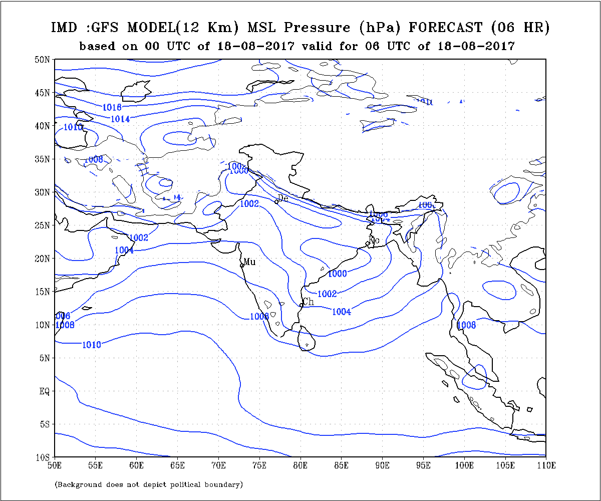
The Axis of Monsoon trough at mean sea level passes through Punjab, New Delhi thence towards Odisha and Central Bay of Bengal.
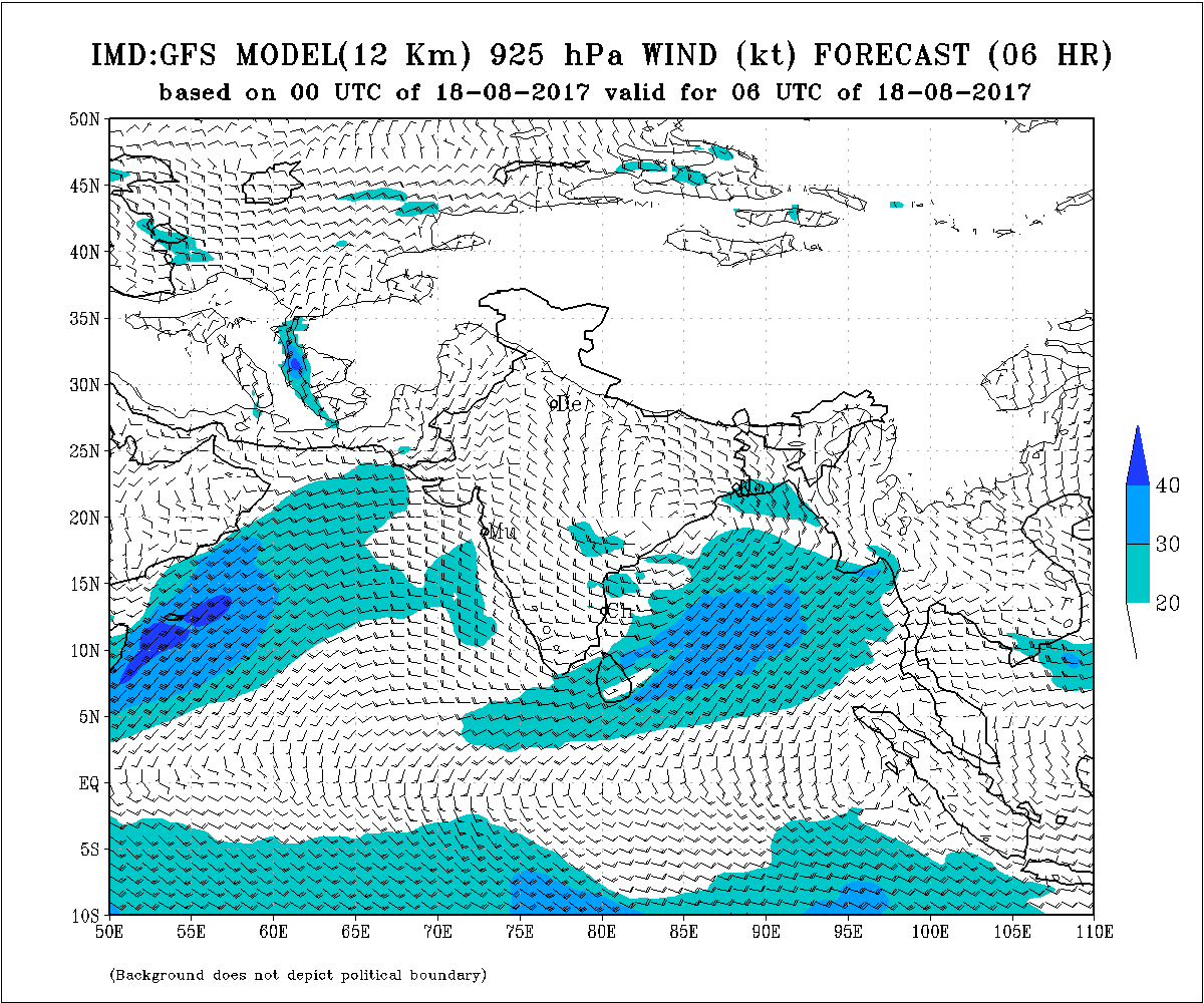
An Upper Air Cyclonic Circulation over North Bay of Bengal and neighborhood yesterday has tracked along the coast Westwards. Under its influence a Low Pressure area has formed along Odisha coast and extends up to 7.2 km above mean sea level, tilting Southwestwards with height.
The System is expected to track in Westerly direction quite fast reach Maharashtra by 20th August. A broad Circulation is expected to form over Maharashtra.
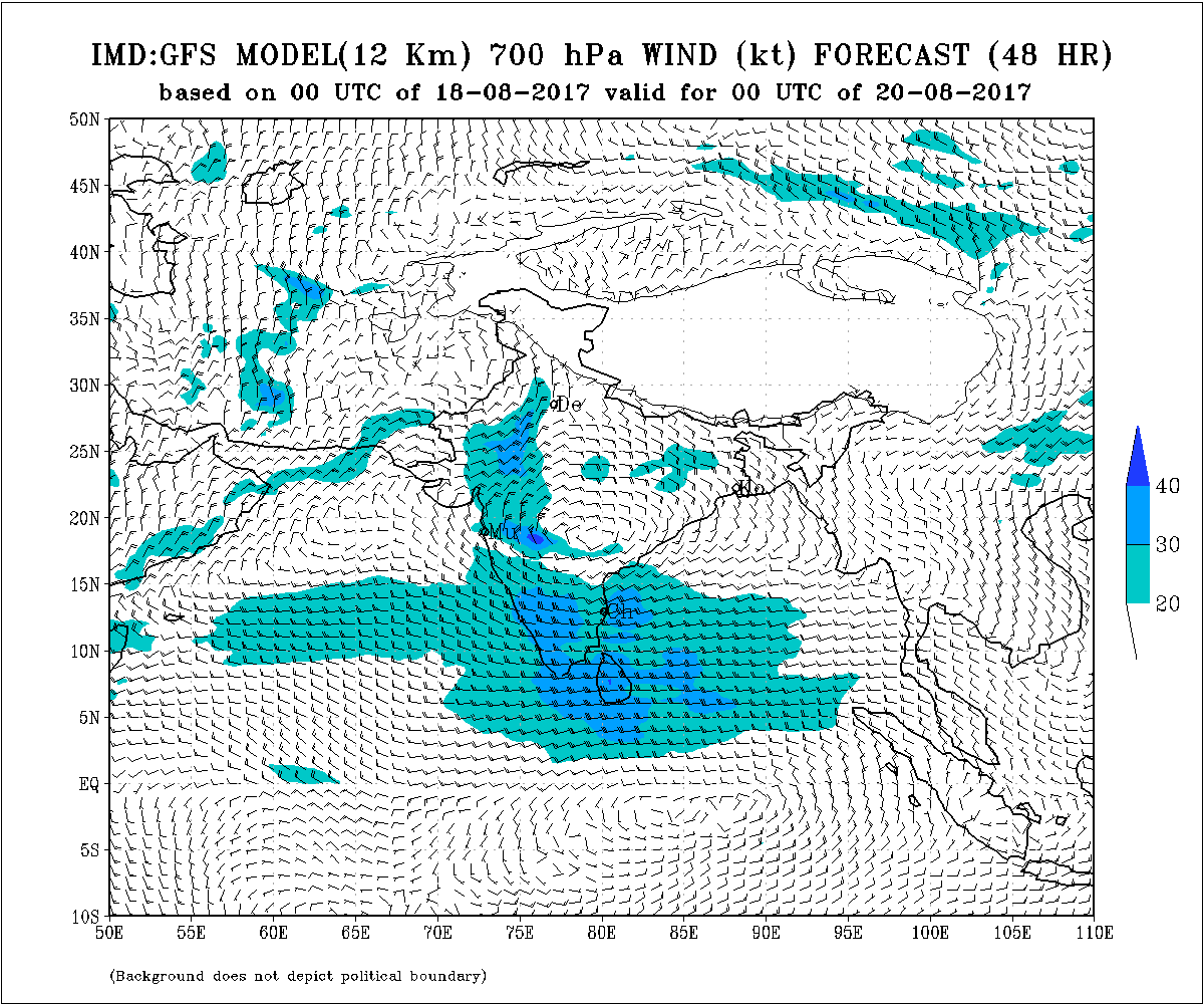
On 20th August the Clouding associated with the System will be mainly on West and South of the System and so some clouding on the West side will reach Gujarat.
Forecast: Saurashtra, Gujarat & Kutch
20th to 27th August 2017
Saurashtra, Gujarat & Kutch expected to get new round of rain on different days as scattered showers, light medium heavy rain during the forecast period. The rain quantum is expected to be erratic area wise. Cumulative quantum for 20th to 27th August will be updated by the forecast date. South Gujarat expected to get higher quantum of rain.
આગાહી: સૌરાષ્ટ્ર, કચ્છ અને ગુજરાત
20 થી 27 ઓગસ્ટ 2017
સૌરાષ્ટ્ર, ગુજરાત અને કચ્છ માં વરસાદ ના નવા રાઉન્ડ માં અલગ અલગ દિવસે છુટા છવાયા ઝાપટા, હળવો-મધ્યમ-ભારે વરસાદની શક્યતા છે. જેની કુલ માત્રા અલગ અલગ વિસ્તાર માં વધ ઘટ રહેશે. માત્રા ની વિગત તારીખ 20 ના જણાવવા માં આવશે.
Caution:
Please refer/rely on IMD/RSMC Bulletins/Advisories for Storms & Weather related matter.
સાવચેતી:
સ્ટોર્મ કે હવામાન અંગે ની માહિતી માટે ભારતીય હવામાન ખાતા/ગવર્મેન્ટ ના બુલેટીન/સુચના પર નિર્ભર રહેવું.
Afternoon Update – બપોર ની અપડેટ
Morning Update – સવાર ની અપડેટ