Current Weather Conditions on 31st October 2012 @ 6.30 am.
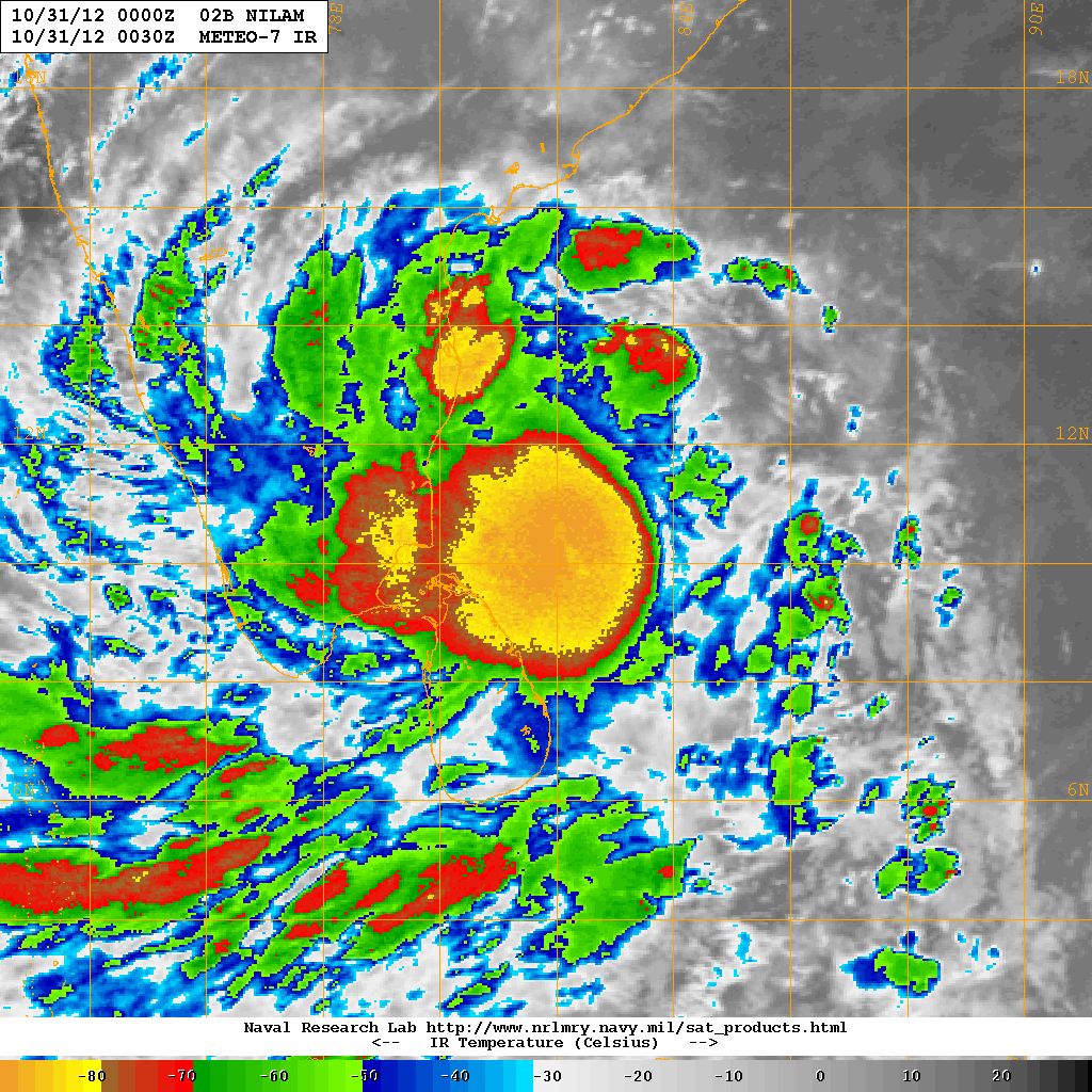
Cyclonic Storm “NILAM” has tracked mainly Northwards during the last few hours and as per JTWC at 000 UTC today the system has 50 Knots winds 985 Mb. Pressure located at 10.3N & 81.8E. about 225 Kms. East Southeast of Nagapattinam. “NILAM” is 350 Kms. South Southeast of Chennai. The system is tracking in 310 Degrees direction at 8 knots. However, the system is expected to track at higher speed of 10 to 12 knots in the next few hours.
As per RSMC/IMD dated 31st October 2012 @ 0230 am. IST cyclonic Storm “NILAM” remained stationary and was located at 10.0N. & 82.0E. with 40 knots winds and 996 Mb. pressure. about 400 Kms. South Souteast of Chennai. Full details given in link below.
NRL Satellite Image on 31st October 2012 @ 6.00 am.
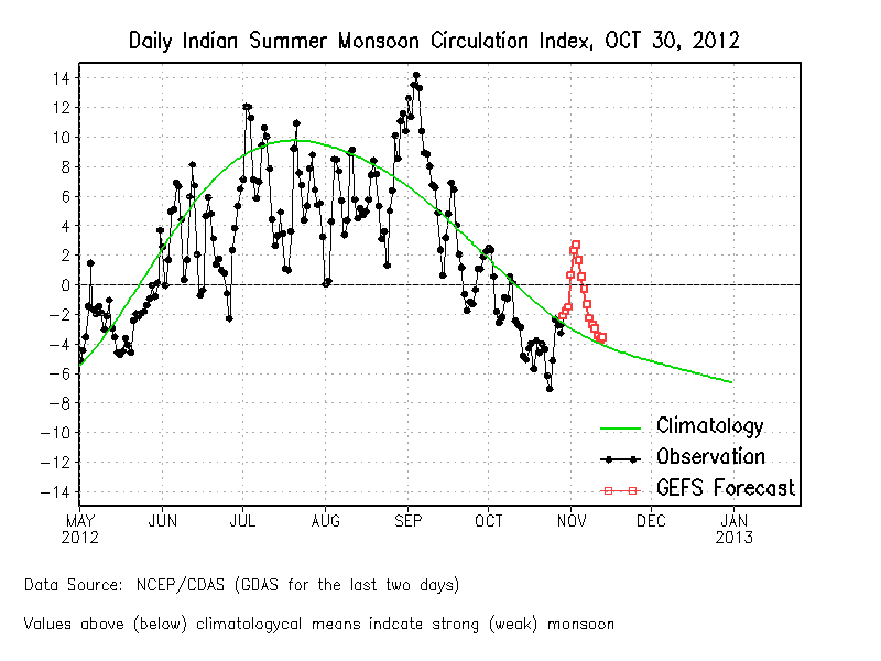
The Daily Indian Summer Monsoon Index is on a steep upwards trend. Index normal for this time of the year is -3 and is expected to reach +3 next few days from 30th October. Though we are into the Northeast Monsoon, the Index below is quite interesting since it is displayed till January 2013. In short the Index can be considered as combined for both Summer as well as Winter Monsoon.
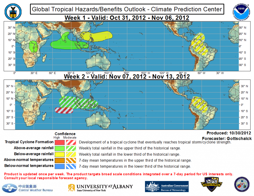
Global Tropical Hazards Outlook
Global Tropical Hazards map shows above average rainfall for Peninsular India in week one while week two shows rainfall in the upper third of average rainfall. However, it fails to show the Cyclonic Storm currently active in the Bay of Bengal and on the way to make landfall over Tamilnadu Coast.
IMD Bulletin No. BOB02/2012/16 Dated 31-10-12 Time 0530 am. IST
Click the above links in new Tab/Window.


