Current Weather Conditions on 22nd June 2015
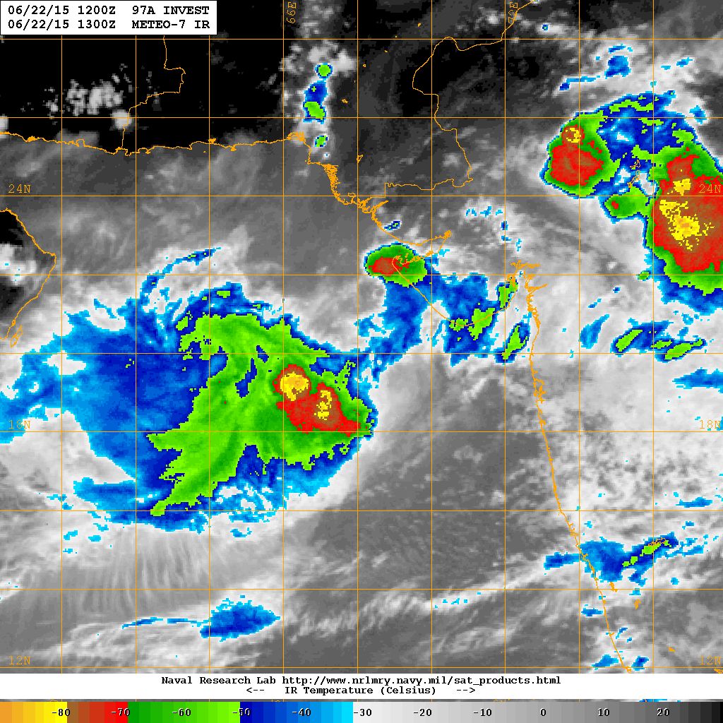
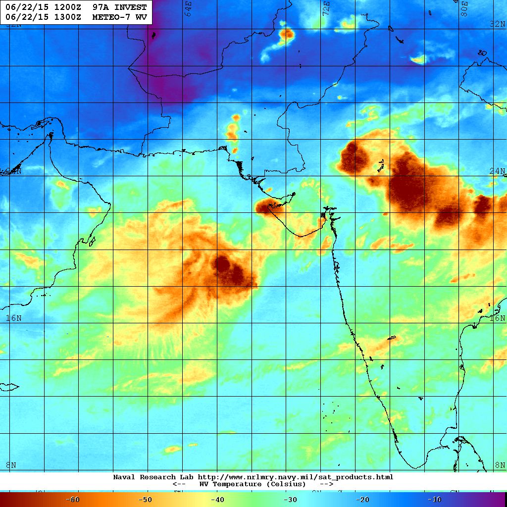
The Well marked Low Pressure over the North East Arabian & Adjoining East Central Arabian Sea concentrated to a Depression over the same region this morning. The location is about 300 Kms. Southwest from Porbandar. The dense clouding associated with this System are mainly located to the West of the System Center. This Depression could strengthen further to a Deep Depression in next 36 hours.
Update will be given if any major changes occur
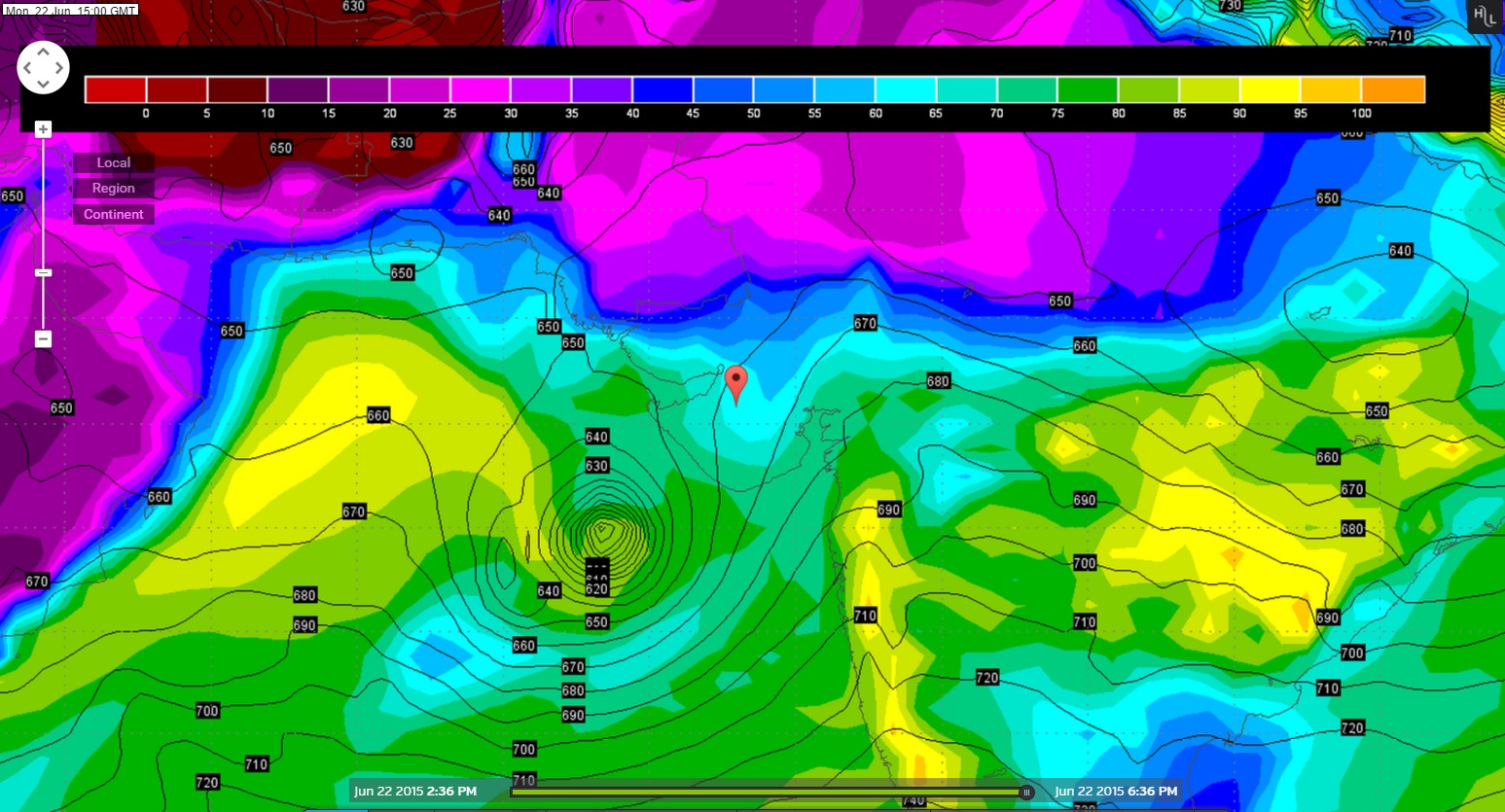
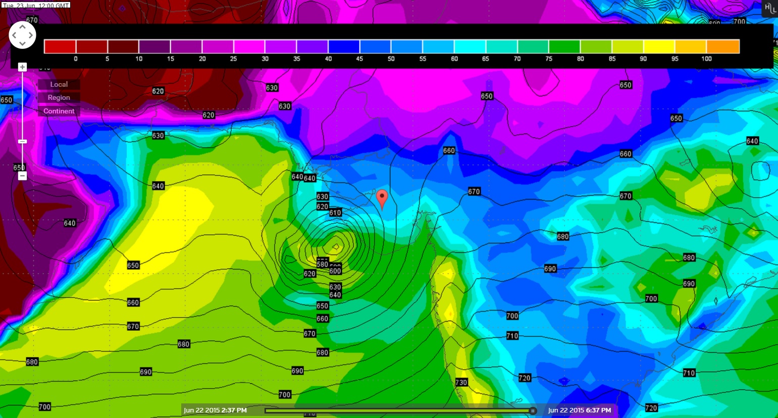
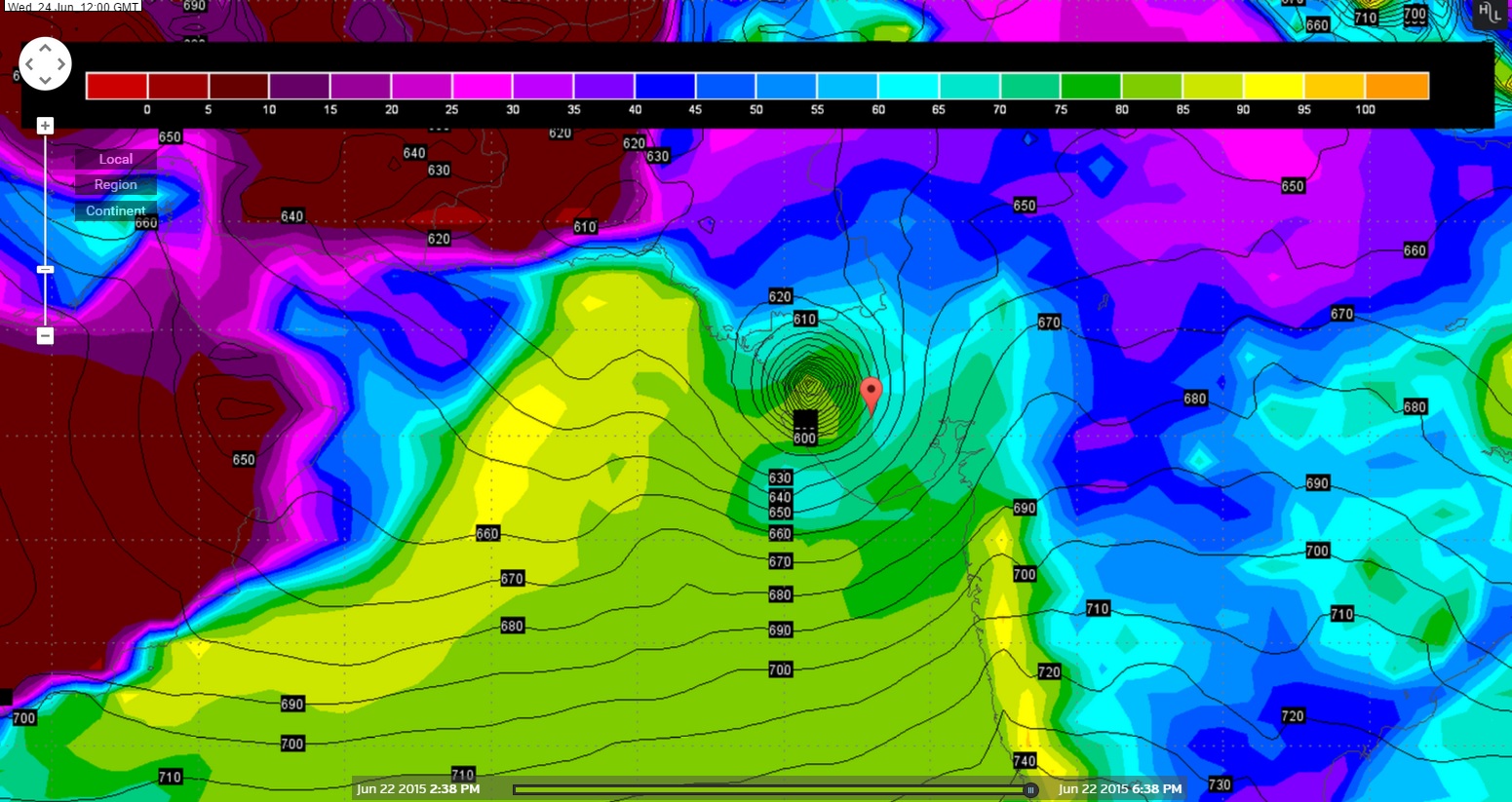
Yesterday we have concluded that the GFS model outcome would stand validated and hence going by that here under is next three days Forecast location of the Arabian Sea System.
Wunderground GFS 925 hPa Chart Valid 22nd June 2015 @ 1500 UTC
Wunderground GFS 925 hPa Chart Valid 23rd June 2015 @ 1200 UTC
Wunderground GFS 925 hPa Chart Valid 24th June 2015 @ 1200 UTC
From IMD Inference on 22nd June issued at 1630 IST based on observations of 1230 IST:
The Depression over over northeast & adjoining eastcentral Arabian sea remained practically stationary and lay centered at 1430 hours IST of today, near 20° North and Longitude 67.0°East about 320 km from southwest of Porbandar. The System is likely to move slowly in west-northwestwards and concentrate into a Deep Depression during next 24 hours.
REGIONAL SPECIALISED METEOROLOGICAL CENTRE-TROPICAL CYCLONES, NEW DELHI SPECIAL TROPICAL WEATHER OUTLOOK
22nd June 2015 1500 UTC Outlook click the link RSMC-New Delhi Outlook
Note: 1 knot =1.852 Kms.
JTWC Reissued at 22nd June 0500z
ABIO10 PGTW 220500
MSGID/GENADMIN/JOINT TYPHOON WRNCEN PEARL HARBOR HI//
SUBJ/SIGNIFICANT TROPICAL WEATHER ADVISORY FOR THE INDIAN OCEAN
/REISSUED/220500Z-221800ZJUN2015//
RMKS/
1. NORTH INDIAN OCEAN AREA (MALAY PENINSULA WEST TO COAST OF AFRICA):
   A. TROPICAL CYCLONE SUMMARY: NONE.
   B. TROPICAL DISTURBANCE SUMMARY:
      (1) THE AREA OF CONVECTION PREVIOUSLY LOCATED NEAR 20.2N
68.2E, IS NOW LOCATED NEAR 19.9N 67.7E, APPROXIMATELY 295 NM SOUTH
OF KARACHI, PAKISTAN. ANIMATED MULTISPECTRAL SATELLITE IMAGERY
DEPICTS DEEPENED CONVECTION SLIGHTLY SHEARED TO THE WEST OF A
DEVELOPING LLCC. A 220312Z SSMIS MICROWAVE IMAGE REVEALS THE BULK
OF THE DEEP CONVECTION DISPLACED WEST OF THE LLCC. A 220142Z WINDSAT
PASS SHOWS A 25 TO 30 KNOT CIRCULATION CENTER WITH STRONGER (UP TO
GALE FORCE) WINDS ASSOCIATED WITH SOUTHWESTERLY MONSOONAL FLOW TO
THE SOUTH OF THE CENTER. UPPER-LEVEL ANALYSIS INDICATES THE
DISTURBANCE IS LOCATED IN AN AREA OF MODERATE VERTICAL WIND SHEAR
AND GOOD DIFFLUENT OUTFLOW. MAXIMUM SUSTAINED SURFACE WINDS ARE
ESTIMATED AT 25 TO 30 KNOTS. MINIMUM SEA LEVEL PRESSURE IS ESTIMATED
TO BE NEAR 990 MB. DUE TO PERSISTENT DEEP CONVECTION AND IMPROVED
LLCC ORGANIZATION, THE POTENTIAL FOR THE DEVELOPMENT OF A
SIGNIFICANT TROPICAL CYCLONE WITHIN THE NEXT 24 HOURS IS UPGRADED TO
MEDIUM.
      (2) NO OTHER SUSPECT AREAS.
2. SOUTH INDIAN OCEAN AREA (135E WEST TO COAST OF AFRICA):
   A. TROPICAL CYCLONE SUMMARY: NONE.
   B. TROPICAL DISTURBANCE SUMMARY: NONE.
3. JUSTIFICATION FOR REISSUE: UPGRADED AREA IN PARA 1.B.(1) TO
MEDIUM//
NNNN
NRL IR Satellite Image on 22nd June 2015 @ 1300 UTC ( 6.30 pm. IST)
NRL Water Vapor Satellite Image on 22nd June 2015 @ 1300 UTC ( 06.30 pm. IST)
Forecast: 22nd June to 26th June 2015
Saurashtra, Kutch & Gujarat
The Rainfall amount and areas will vary on day to day basis as the System tracks towards/over Saurashtra/Kutch/North Gujarat during 22nd June to 26th June of which very heavy rainfall in some areas between these dates.
ટૂકું તને ટચ : ઊત્તર પૂર્વ અને લાગુ મધ્ય પૂર્વ અરબી સમુદ્ર માં ડીપ્રેસન છે જે પોરબંદર થી 300 કિમી દક્ષીણ પશ્ચિમે છે.
હાલ નું નિદાન: આ સીસ્ટમ પહેલા 12 કલાક ત્યાંજ રહેશે ત્યાર બાદ સૌરાષ્ટ્ર તરફ અને પછી કચ્છ તરફ આવશે તેવું અનુમાન છે. 24 કલાક માં ફેર ફાર હશે અપડેટ થશે.
ચોમાસું હવે બેસવા ના સંજોગો થયા છે. સૌરાષ્ટ્ર, કચ્છ અને ગુજરાત ના મોટા વિસ્તાર માં ચોમાસું નોતું બેઠું, ભલે છૂટો છવાયો સારો વરસાદ થઇ ગયો હોઈ. ક્યાં કેટલો વરસાદ થાય તે નક્કી ના હોઈ કારણ કે આ વરસાદ હાલ સીસ્ટમ આધારિત છે.
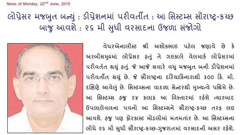
Weather Forecast In Akila Daily Dated 22nd June 2015
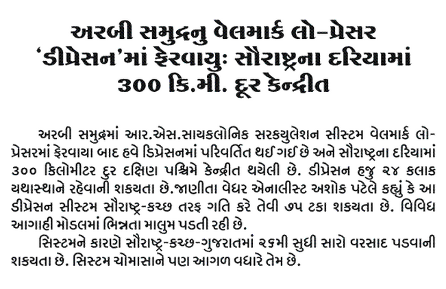
Weather Forecast In Sanj Samachar Daily Dated 22nd June 2015
Caution:
Please refer/rely on IMD/RSMC Bulletins/Advisories for Storms & Weather related matter.
સાવચેતી:
સ્ટોર્મ કે હવામાન અંગે ની માહિતી માટે ભારતીય હવામાન ખાતા/ગવર્મેન્ટ ના બુલેટીન/સુચના પર નિર્ભર રહેવું.


Aa system average saurashtra. Ane gujarat ma ketla inch varsad apchhe pl reply
Gujarati ma spat lakhechhe madhyam, bhaare, ane amook center ma ati bhaare.
sir tamaro vyavasay su chhe?havaman khatani job chhe?
Havaman Khata ni job nathi.
Jay mataji bhai ne
Porbander ma kyare varsad aavse
Janav so pls
23/24 tarikh
Sir aa sistem thi kuchh ne khubaj faydo these tevu Maru anuman che.. Tame Su kaho cho…?
Navi update jovo
navi update kyare apso?
sir updet ma Hindi ma aapo to vadhare saru mob. ma Gujarati nathi aavtu mate
Shakya nathi
Sir.dt23time.9.45 am weather chart nu avlokan dt24 saurastra na kanthe majbut diprestion takrase.DT.25kutch upper pasar thay Pakistan upper pasar thse dt26.anuman barobar chhe.pls ans
Navi update jovo
Good morning sir
As per IMD system is slightly moved towards east side. And will be move to east-northwords so its good sign for saurashtra. And sir if it convert to deep depression than it banificial or not
Ashok bhai tame khedut bhaio ni coment na jawab aapo ea badal tamne khub khub aabhar bhai
Jay sri krishna ashok bhai depression thi salaya distric ma varsad aavse?..ANE JAY SRI KRISHNA
sir Wednesday to friday ni aagahi arabi samudra ni system ni hati k bay of bangal system ni
Arabian Sea
Sirji now the clouds which are over Gujarat region are SW monsoon clouds or they are associated with this 97A low
Yes
Su low pressure nabdu pade 6e?
Hansrajbhai tamo kayam navu gotyavo chho. Nabadu nathi. Ane aa low pressure nathi pan Official Depression chhe.
sir jtws alert cyclone formation
Read new update
sir good morning
547 model to 23th na sourarstr cost ma hit kare aevu batave che?
Sir Halvad Ma savanna 4 vagyathi chata chalu thaya che
sir jamnagar darya kadha vistarma varsad kevo rehse
Hi Ashok bhai,
After so many days….rainy atmosphere returning to Ahm. Right now light rain is gng on…some windy too and heavy clouds are being passing from the sky but nothing much happening 🙂
Arabian sea ni system thi Amreli jila na area ma varsad avani sakya ta khari sir plz ans.
Tamo email address khotu vaparo chho…. chhata haal tamone jawab apu chhu …. Ha varsad saro thashe.
Email address sachu nahi vaaparo toe jawab nahi maaley havey pachhi.
It looks as if next 24 hrs are vry crucial…waiting for a dashing rain in gujarat…
Sir m.p ni mathe nu low presser gujarat ma avi sake ?
ghar aangane chhe tene vadhavo !
Sir pawan ni desa ky Rahese
Pavan areawise fer far thaya karshe. Pachhi dakhsin Pashchim thashe.
Sandesh news nu lolmlol havaman vibhag ni aagahi arbi ma thau deep depression .
Sir arabian ni system depression ma thi cyclone ma parivartit thavan chances che???
Haal 24 kalak ma nahi. Majboot thaay toe Deep Depression thaay pahela.
Tankara taluka ma varasad nathi kyare thase
Tankara Saurashtra ave chhe.
Ashok bhai 23,24,25 June mn sindh k sahli elko mein barish k katne Amkant he,Sindh mien garmi se ab tak 400 Afrad halak ho chuke he Aur ye Harm I kab kam hoge
sir. a a gfs vara kem vare vare fare6 have te pak. baju ane oman baju msl dekhade 6. to shu guj. ma nai ave? k te pacha fari jahe
Vadhu majboot bane ane dariyama vadhu samay rahe toe IMD kahe chhe tem Pashchim baju jaay.
Sri dipreesan vavajoda ma pari vartan tai kutch taraf fatavani sakyata
Update vancho…. je mahiti chhe te aapi chhe…. mahenat karo vanchvani.
Sir system na track ange Chokkas mahiti kyare malse
Forecast model fer far kare tem karvu pade. Mat mattantar hoi aapade nakki karvu pade. Lake 12.00 bapore vadhi nakki thai jashe.
Sir. As compared to yesterday to today morning, The clouding over the depression seems to have become disorganized.
What does this indicate ?,
Anything related to its weakening ?
It will be beneficial if it does not strengthen further.
Sir, very good rain Surat from today’s early mornin. And whole day…
Sir surat ma varsad saro 6 pan vijali ane gajto kem nathi
Tamare chomasu besi gayu chhe etle.
Arabian sea ni system thi himatnagar area ma varsad avani sakya ta khari?
General chomasu besva na sanjogo thaya chhe. Yes varsad avashe.
Sir
Deep depression ni intensity low thati hoy tem lage chhe to apne saurashtra ma varsad aa system thi dharya karta ochho padse ke kem?
Depression chhe….. vancho
sirJambusar ma varsad sharu 8:45 Pm
Sir, that’s what I have commented in the morning but unfortunately you have truncated my comment.
Rajan Mehta,
There have been cross posting from many website and it would clutter this website. Here you have people just learning ABC and who are experts in this field. It would be better if I keep it simple for new comers or else they will be confused and the number of comments regarding those post will burden me.
Hope you understand.
Sar deep depresion thi vavazodu bani shake a system thi avi shakyata khari?
Aa System Depression chhe.
Greetings
How will the rains be for Ahmedabad.
Will this system brig in a lot of rain for Ahmedabad
You will get your share of rain and relief from the unbearable hot humid weather.
sir,What about bob system,u r not clerify that.
BOB system Jharkhand and WB baju varsad varsave che.
Gujarat ne lagu na pade.
Good news sir
Yes west north-west direction keh che IMD
aavata 24 kalak nu kahel IMD pramane
aa system thi tharadma kevo varasad thase?
Kora vistaro cover thai jashe.
Thanx sir for good newz n sir aa system ne lidhe ketlo inch varsad these ae Kay kahi sako tame
what about BOB system?
Chhatishgah, Jharkhand baju varsave chhe..
Te aa baju na ave.
Baaki nu chomasu trough babat ma bija comment ma janavel chhe te vancho.
Sir bob vari sistem pan gujrat ni najdik avi gai che to su a pehla varsad apse gujrat ane ema pan central gujrat ma pls sir rply….
M.P. ma vadado chhe te BOB ni system na nathi. Te chomasu poorva pashchim na pavano nu trough chhe tena chhe ane chomasa darmyan jyan aa trough pass thaay tyan hoi.
Samanya rite Rajastan, M.P. Chhatishgarh, Odisha ane BOB evi ritey hoi vadado vadhu matra ma.
Sir imd gfs 574 model oman taraf janu kahe chhe