Current Weather Conditions on 2nd November 2012 @ 8.00 am.
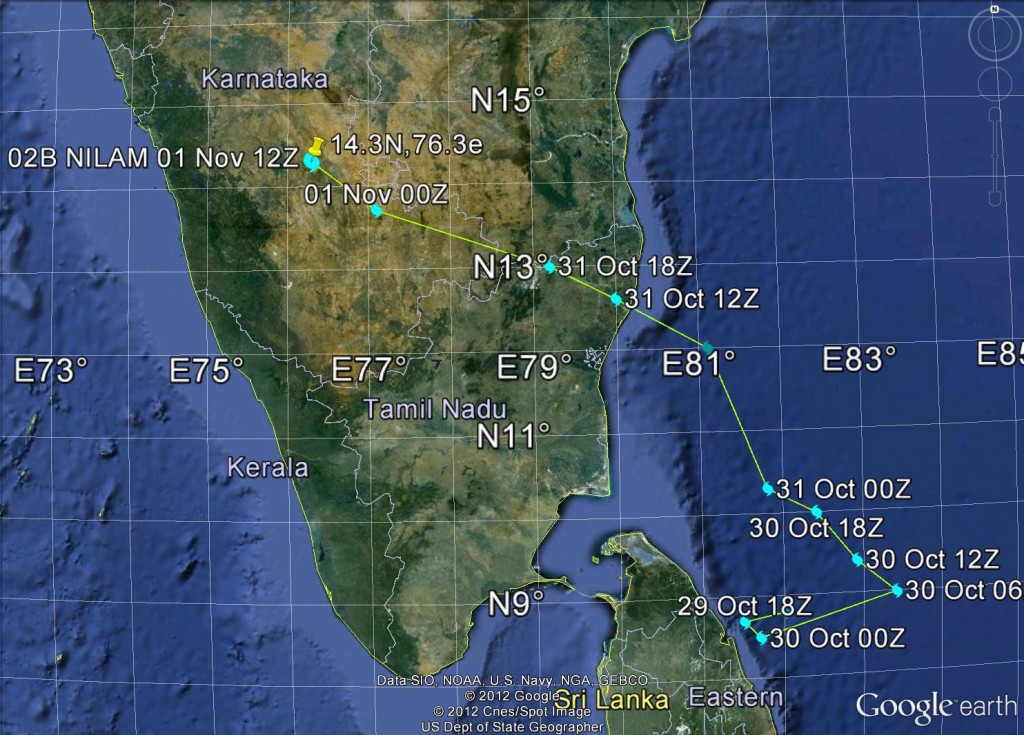
Cyclonic Storm “NILAM” made Landfall over north Tamilnadu coast near Mahabalipuram, South of Chennai (near latitude 12.60N and longitude 80.20E) between 1600 and 1700 hrs IST on 31st October 2012. System tracked Northwestwards across North Tamilnadu and into Karnataka along Karnataka – Andhra border weakening to a Depression. Yesterday evening 5.30 pm. IST, the 1st November 2012 the System was located near Chitradurg, and vicinity. This morning it lay over broader area of Karnataka as a Well Marked Low Pressure at 1004 Mb. Associated Cyclonic Circulation extends up to 500 Mb. The 1006 Mb. Isobar is spread across most of the Southern Peninsula and part of it extends over the Arabian Sea
Track of Cyclonic Storm “NILAM”as per NRL
From 29th October 1200 UTC to 1st November 1200 UTC
The Low Pressure is expected to weaken, however, the 850 Mb and 700 Mb Cyclonic Circulation associated with this Low Pressure will persist at least up to 4th November.
The 850 Mb. Circulation is spread over tri state border area of Karnataka, Maharashtra and Andhra. It is expected to drift Northeastwards over vicinity of Bellary , Gulbarga, Ruyyadi, and Nagpur by 4th/5th.
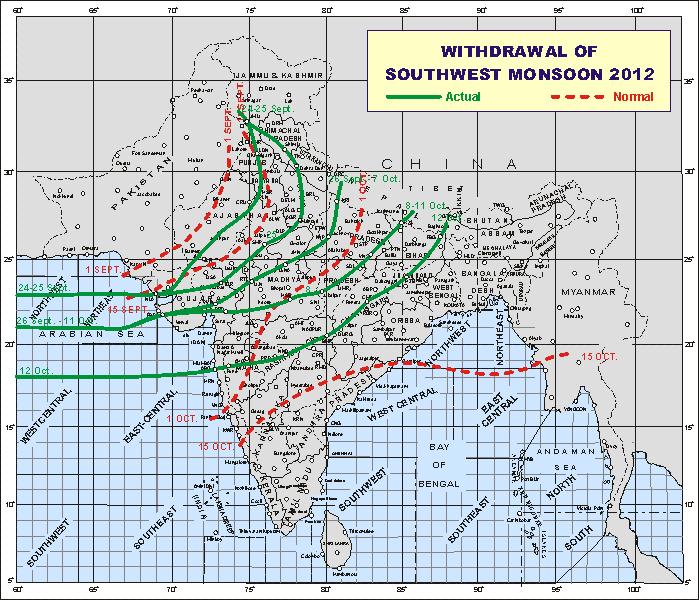
Post Cyclonic Storm “NILAM” weather scenario is such that the Northeast Monsoon has been put under hold and as if Southwest Monsoon is revisiting. Rewind the clock back to 12th October 2012 !
Map showing the Southwest Monsoon withdrawal till 12th October 2012
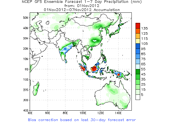
Most areas South of the 12th October Green line are forecast to receive Rainfall during 1st to 7th November.
NCEP GFS Rainfall Map 1st November to 7th November 2012
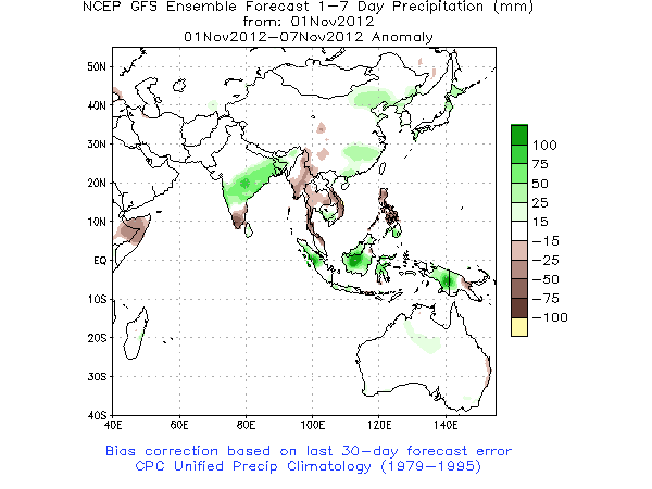
Anomaly Map showing Tamilnadu receiving less than normal rainfall for this period.
Tamilnadu, parts of Andhra Pradesh, Karnataka received good rainfall due to Cyclonic Storm “NILAM”. Remanant of “NILAM” as an Upper Air Cyclonic Circulation will give Rainfall over Karnataka, Andhra Pradesh, Maharashtra, Orissa, Chhatishgarh, West Bengal, and adjoining areas of Jharkhand during 1st to 7th November.


