Current Weather Conditions on 7th September 2013 @ 11.00 am.
There has not been meaningful rainfall over Saurashtra during the last five to six days.
As per IMD the criteria for Withdrawal of SW Monsoon :
a) Withdrawal from extreme north-western parts of the country is not attempted before 1st September.
b) After 1st September:
The following major synoptic features are considered for the first withdrawal from the western parts of NW India.
i) Cessation of rainfall activity over the area for continuous 5 days.
ii) Establishment of anticyclone in the lower troposphere (850 hPa and below)
iii) Considerable reduction in moisture content as inferred from satellite water vapour imageries and tephigrams.
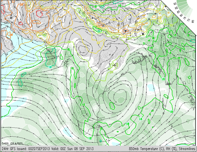
On examining the above criteria, there has not been rainfall activity over Northwest Rajasthan for last seven days. The Anticyclone had not formed till today, however, the formation of Anticyclone at 850 Mb. level has started to form today.
COLA Map of 850 Mb. valid 8th September 00 UTC
Also as seen from Water Vapor Satellite Image shows considerable reduction of Moisture content over Northwest Rajasthan.
IMD Water Vapor Satellite Image on 7th September 10.00 am.
There is a Cyclonic Circulation over the West Central Bay of Bengal as can be seen from the COLA Map for 850 Mb. This needs to be watched for further development into a Low Pressure area.
Forecast: 7th to 12th September 2013
60% Saurashtra expected to receive 2 Cms. to 3 Cms. of rainfall during the forecast period mainly around 10th/11th September.
40% Saurashtra expected to receive only Showers to some places getting up to 2 Cms. of rainfall during the forecast period.


