ગુજરાતી માં આપેલ તારીખ ૮ સપ્ટેમબર ની મારી આગાહી હજુ અમલમાં છે.
Gujarati Forecast dated 8th September still valid.
Current Weather Conditions on 10th September 2012 @ 10.30 pm.
The Low Pressure and associated Cyclonic Circulation over Sindh, Kutch and nearby area still persists.
There is another Cyclonic Circulation from the Bay of Bengal which has tracked over Orissa and is currently over Chhatishgarh and vicinity and the same has descended to the ground to form a Low Pressure area. The Convective clouds associated with this System are spread mainly to the West of the System over Madhya Pradesh and adjoining Gujarat.
The axis of monsoon trough at mean sea level passes through Kota, Sagar, Center of Low Pressure area, Phulbani, Puri and thence Southeastwards to Eastcentral Bay of Bengal. The off-shore trough at mean sea level from south Gujarat Coast to Kerala
Coast persists.
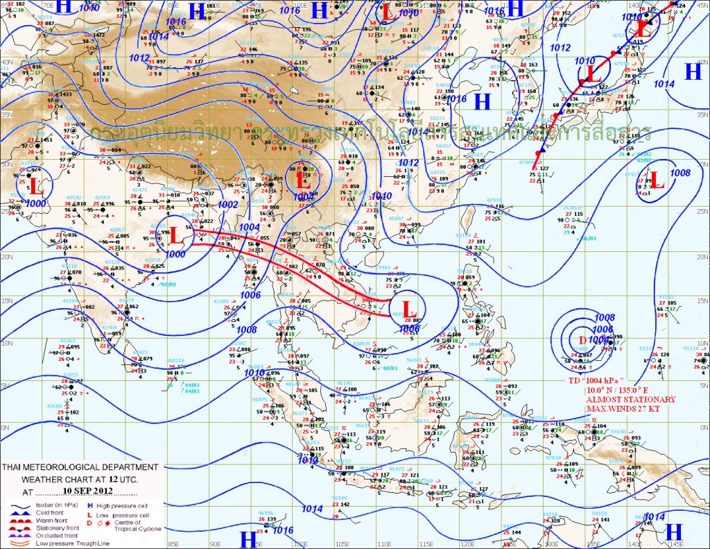
The Position of both the Low Pressure is shown in TMD Map of 10th September at 5.50 pm. IST.
Forecast: till 14th September 2012
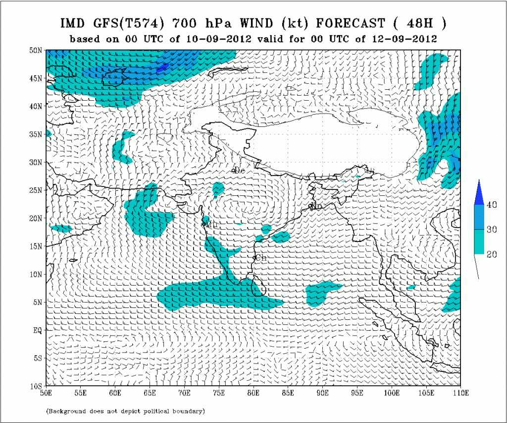
The System from Chhatishgarh will track towards Madhya Pradesh and on 12th both the the Upper Air Cyclonic Circulation will align from East to West, one from Madhya Pradesh to Gujarat and another UAC over Kutch & Saurashtra vicinity as shown in the 700 Mb. Map from IMD.
Scattered rain to continue till 13th/14th over parts of Gujarat and parts of Saurashtra.

